|
|
1. OHPASS 2012
2. UC-win/Road OHPASS Plug-in Option
3. Overseas Training and Seminars
|
| 1. OHPASS 2012 |
OHPASS (Optimal Highway Path Automatic Search System) is the method for
calculating the optimal path of highways and other types of road. OHPASS
uses the genetic algorithm.
The examination technique that can simulate the road alignment flexibly and quickly in the design stage was required and thus FORUM8 received a commission from Laboratory of Japan Highway Public Corporation (JH) (current: Nippon Expressway Research Institute Company Limited (NEXCO)) to do the job of providing a solution, and Mitsubishi Research Institute, Inc. did the work of modeling the vertical and horizontal road alignment. Way point alignment model and genetic algorithm are devised to be used for the process of evaluating and optimizing the road alignments that are designed based on these vertical and horizontal road alignment models.
This has lead to the building of Optimal Highway Path Search System "OHPASS" which allows users to simulate and evaluate the road alignments designed on top of the digital terrain data, reduce business costs, and improve the balance of earthwork volume.
Here is an introduction on OHPASS and its linkage with UC-win/Road. |
Function and overview of OHPASS
|
The workflow of this program is as follows.
- Define the initial conditions
- Assign various calculation conditions
- Display the calculation result
Define the initial condition
Define the following 3 files and load them as initial conditions.
Digital terrain data
DXF file that includes the 3D dimensional terrain data is used. Imported
terrain data will be converted to 3D terrain mesh.
Definition of planning linear
Prepare a temporary road alignment and assign a rough range to allow room
for alignment calculation. Adjust the range according to the terrain. If
the borderline of the terrain range is not set, you may encounter a problem
in which the road alignment cannot be defined.
Setting the control points
Along the horizontal road alignment, assign points to avoid and do the same thing along the vertical road alignment.
Assign various calculation conditions
Then assign various calculation conditions.
In order to obtain optimal road alignment, there are several conditions that need to be defined such as road alignment condition, cross section settings, construction costs, control point settings, algorithm, and evaluation settings.
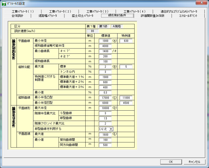
Road alignment condition
Set the maximum and minimum radius of horizontal and vertical road alignment.
Assign the dimensions of each cross section, small structure, tunnel, bridge,
and slope.
 |
|
 |
Figure 1
Road alignment condition settings window |
|
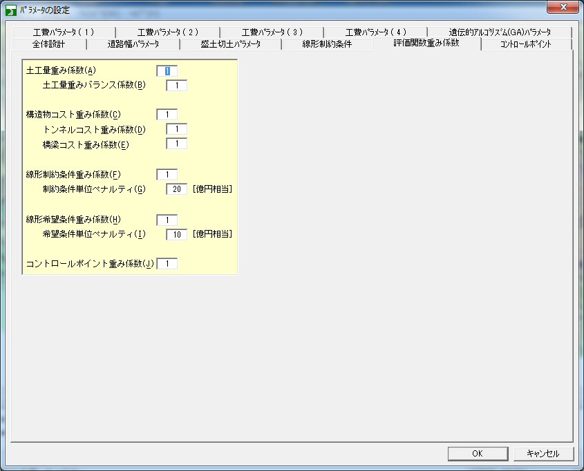
Figure 2
Road design parameter settings window |
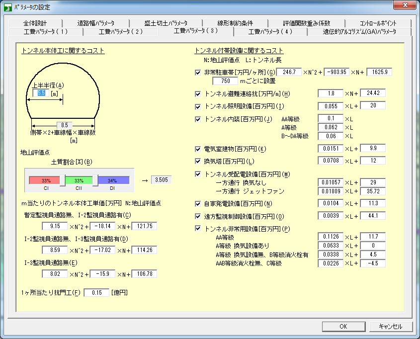
Assigning the condition of construction costs
 |
Figure 3
Construction cost condition settings window |
Assign algorithm
Assign the upper age limit for road alignments subject to calculation.
All road alignments at this age or younger will be calculated. Also, assign
the rate at which modification occurs in road alignments.
 |
Figure 4
Generic Algorithm settings window |
Evaluation settings
Not only can you assign road alignment's construction cost, you can also
assign weight to earthwork volume, tunnel, bridge, etc. and assign penalties
to be imposed in case the road alignment conditions are not met.
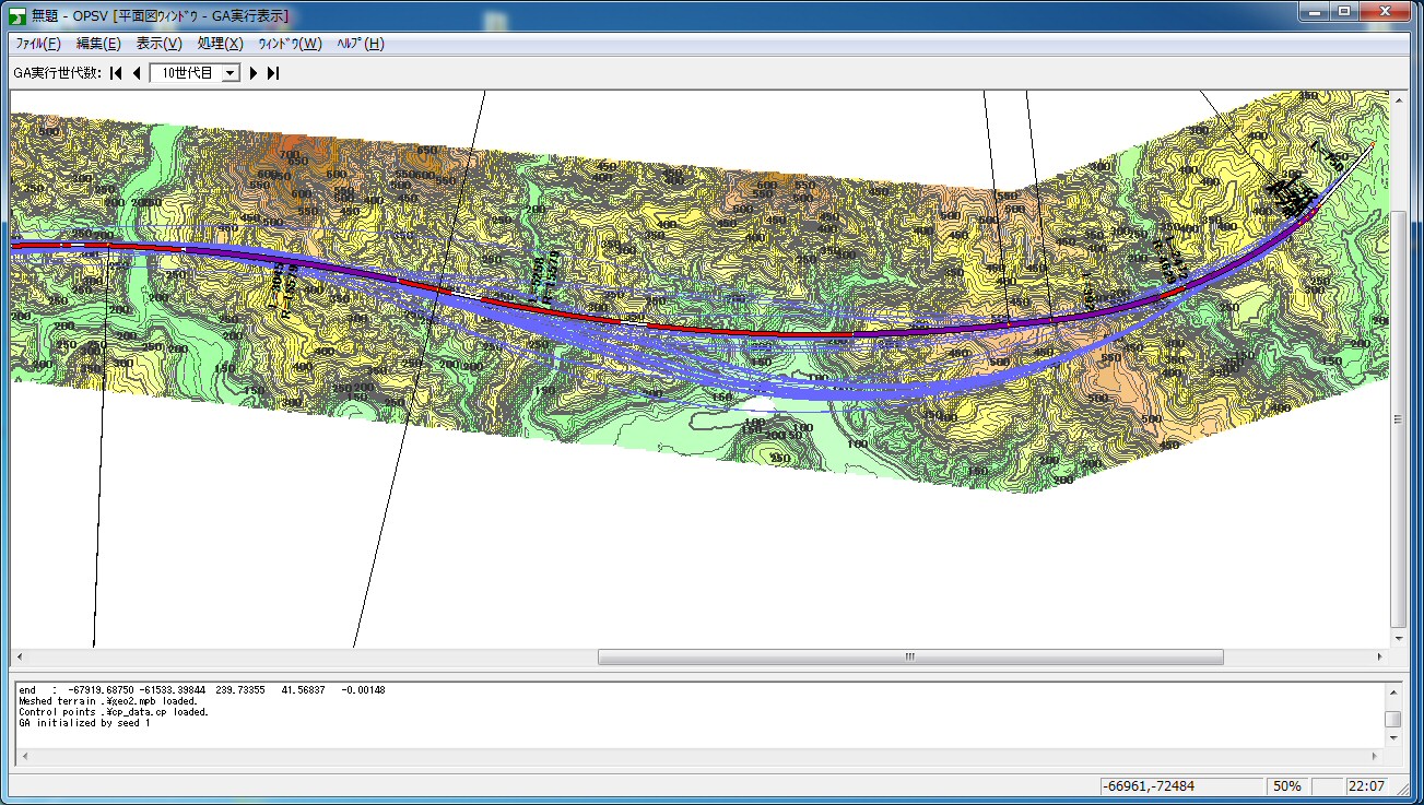
Display calculation and result
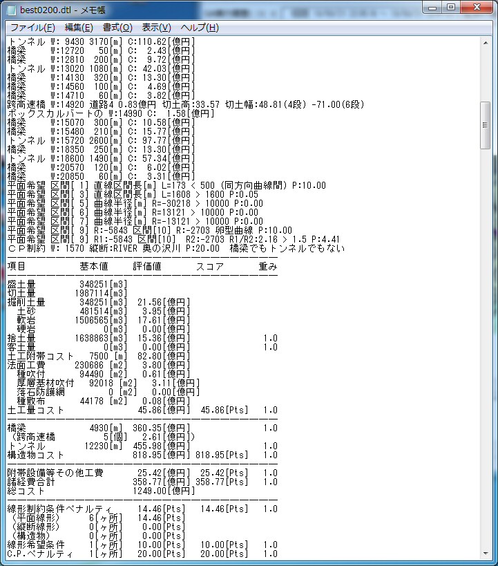
During the calculation, initial road alignment, road alignments grouped into generations, and optimized path are drawn and the calculation results are displayed for confirmation.
The results are output to a text file that describes the optimal path and construction costs for you to confirm and evaluate.
 |
|
 |
Figure 5 Window for calculating
the construction costs and evaluation |
|
Figure 6 Display the generated optimal path. |
|
|
| 2. UC-win/Road OHPASS Plug-in Option |
The calculation result can be linked with UC-win/Road.
The optimal highway pass obtained by calculation can immediately be visualized in UC-win/Road thanks to its seamless linkage with OHPASS. |
First of all the result data from OHPASS is loaded and converted. The interval
information of terrain, horizontal and vertical road alignment, road's
cross section, earthwork, bridge, and tunnel is output from the result
data as LandXML file, a very versatile file format.
Next, LandXML file is imported to UC-win/Road.
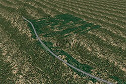
By representing the path optimized by OHPASS on UC-win/Road within its 3D environment, you can confirm the determined path not only by looking at its numerical value and image but also by viewing the path as a very comprehensive information that has been visualized over the terrain within the 3D environment. The path can also be confirmed by driving over it.
Once the road alignment has been imported to UC-win/Road, you can change the cross section, the slope, and in some cases the road alignment itself as required.
Moreover the image of a completed road can be confirmed by placing buildings, trees, road signs, and street furniture along the road.
By visualizing the path within the 3D VR environment and driving over it
using the UC-win/Road driving simulation feature, you can confirm the visual
range of the determined path, the position in which street furniture is
arranged, the visibility and color of road signs, and the overall view
all seen from the driver's perspective for further consideration. You can
add more realism by assigning scenarios, changing traffic volume and weather
to experience driving under any conceivable road condition.
 |
|
 |
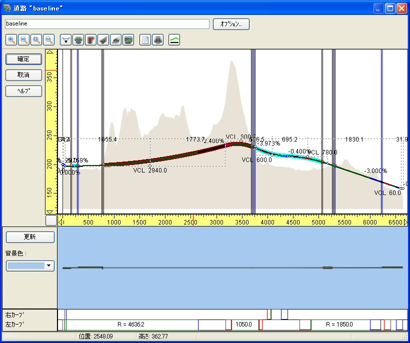
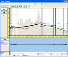
| Figure 1 Longitudinal profile |
|
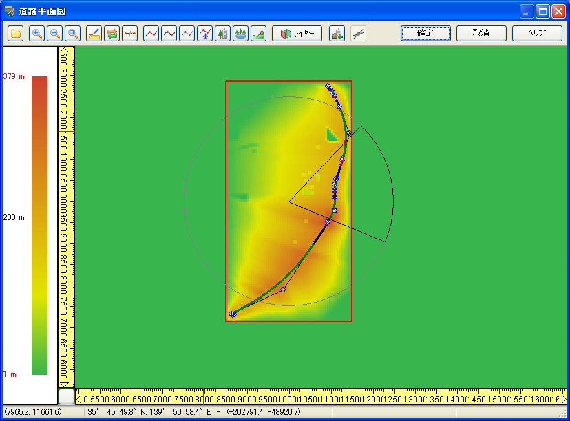
Figure 2 Screen of plane |
 |
| Figure 3 After converting |
|
|
| 3. Overseas Seminars and Exhibition |
Exhibition
| Date |
Exhibition
Name |
Location |
| 4-7 June, 2013 |
ITS European Congress |
Dublin |
For more information and applications, please email us at
mailto : forum8@forum8.com
Gross circulation:6654
To subscribe this page, go to http://www.forum8.co.jp/english/p-mail-e.htm
If you would like to unsubscribe from our newsletters, please include "Unsubscribe"
in the subject title of your email and send it back to us.
Thank you for your continued support.
FORUM8 Co., Ltd. mailto:forum8@forum8.co.jp
Nakameguro GT Tower 15F
2-1-1 Kamimeguro Meguro-ku Tokyo 153-0051 JAPAN
TEL +81-3-5773-1888
FAX +81-3-5720-5688
http://www.forum8.com/ |
|