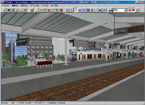
UC-win/Road UC-win/Road
 |
 UC-win/Road Standard Cost Estimate List UC-win/Road Standard Cost Estimate List
 Estimated Price Structure Estimated Price Structure
| Estimated Price |
| Direct personnel costs |
[(Estimated distance A) * Work unit (per km) B + Option work unit C] *
Engineer work unit cost D |
| Administrative costs |
Direct personnel costs * 20% |
| General costs |
Technical costs(Field survey cost etc.), Express charges(25% extra charge
for overtime working etc.), software/hardware purchase costs,
Apparatus rental/ transportation, Satellite photography costs, Transportation
costs (actual cost), Work management costs |
|
|
Breakdown of standard estimate
| Estimated distance |
|
Correction Coefficient |
Remarks |
The total extended distance
(km) |
Sandard cross-section |
1.0 |
Four lane, Guardrail for divided road/pedestrian and vehicular segregation,
No edge-processing |
| Cross-sectional change |
1.5 |
Transition area, Emergency parking bay, one-way grade, On/off- ramp |
| Grade crossing |
2.0 |
Depending on a scale of intersection (exclusive of no processing) |
| IC・JCT |
1.7 |
Total application extended distance / Using the outer spaces as a precondition |
| Tunnel part |
1.0 |
Exclusive of mine- mouse special processing |
| Bridge part |
1.5 |
Same treatment as a cross-sectional change |
| Construction zone(Berm processing) |
1.3 |
Berm settings |
| Others |
0.5 |
Separate estimate |
| A |
Subtotal(A) Estimated extension distance |
| Work Classification |
Breakdown |
Correction Coefficient |
Standard work unit |
Remarks |
Terrain information
(man-day) |
Standard 50m mesh use |
1.0 |
(0.15-0.4) |
No terrain processing, one mesh block (10km square ) is 0.15, two blocks
are 0.3 and four blocks are 0.4 |
| Standard terrain editing |
1.0 |
(0.1-1.5) |
Surrounding road, around10m mesh, Editing rate for the total extended distance.
Tunnel entrance, Underpass processing |
| Space base use |
1.0 |
0.2 |
|
| Aerial photograph use |
1.0 |
(0.2-0.3) |
Photo image editing is estimated separately. Pasting reference drawings
in case that accepted data has no plain linear information but only drawings. |
| DXF conversion |
0.5 |
(1.0-3.0) |
Correction= multiple of 0.1,which is set the standard for 200m of straight
road * the rate of total extended road. |
| XML |
1.0 |
(1.0-2.0) |
Using Road standard XML and LandXML provided by a user |
Definition of liner
(man-day) |
IP calculation work |
1.0 |
0.3 |
IP calculating with Calc_IP.exe developed by Road technical support.
IP calculation, IP extraction and IP estimation work. |
| IP input |
1.0 |
0.15 |
When LandXML is provided, it is set that IP =0.0, vertical section =0.1
and interval setting =0.1 |
| VC input |
1.0 |
0.2 |
|
| Classification Setting |
1.0 |
0.2 |
|
Cross-sectional definition
(man-day) |
Cross-sectional definition |
1.0 |
0.8 |
0.4 is counted when LandXML is used. |
| Cross-sectional texture setting |
1.0 |
0.3 |
|
3DModel ・Texture
(man-day) |
Resolution level-Low |
1.0 |
1.0 |
Minimum adjustments with only standard textures. |
| Resolution level-Medium |
1.0 |
2.0 |
Standard adjustments of models /cross sections with standard textures. |
| Resolution level-High |
1.0 |
3.0 |
Advanced adjustments and creation in space with based on the collected
data or materials |
| Resolution level-Excellent |
1.0 |
(3.0-5.0) |
Excellent performance, compared favorably with live-action video. |
| B |
Subtotal(B) Man-day per km |
Medium Resolution
 |
High Resolution A
 |
|
| Work Classification (Option) |
Breakdown |
Correction Coefficient |
Standard Work Unit |
Remarks |
| 3DModel ・Texture(man-day) |
3DModel |
100 elements |
1.0 |
Refer to the sample estimation as below.
A POV-Ray setting model is 1.2 times. |
| MD3Model |
1body |
1.0 |
Standard level of one human model creation.
Standard human model, standing and no cloth changing. |
| 3DTrees |
2 types |
0.8 |
leaf and bark textures making are included |
| Texture |
5 textures |
0.5 |
Intersection textures (Rotary and L- shaped) are two times.
Complexity is also considered. |
Settings and adjustment of simulation
(man-day) |
Traffic setting |
10 roads |
0.5 |
Traffic flow settings.
Root adjustments in an intersection.
Linking with Tracks is 0.1. |
| Signal control setting |
1 crossing |
0.5 |
A suit of settings such as traffic signal model arrangements, stop points,
traffic controls, and phases.
Linking with Tracks is 0.1.
Intersection controls without traffic signals are 0.25. |
| A model of operation and a WAY-P setting |
20P/20PT |
1.2 |
Lane-changing function is included. |
| Flight path setting |
20PT |
0.3 |
Man hour input is required for routing of MD3. |
| Default/Before/After setting |
BFR/AFT |
0.5 |
Settings of Before/After.
Or arrangements of disaster model. |
| Lake setting |
50PT |
0.5 |
Separate estimate for texture creation |
| Stream setting |
10 sections |
0.5 |
Separate estimate for texture creation |
| Script setting |
|
1.0 |
20STEP is counted as one work unit (man-day.) |
| Data setting |
|
1.0 |
Planting, intersection processing, model arrangements, other data adjustments.
A POV-Ray adjustment is included.
Input for each estimate is required , but it depends on the volume of data |
| Output(man-day) |
Screen output |
A41sheet |
|
0.07 |
|
| A31sheet |
|
0.1 |
|
| AVI output (1minute) |
Low |
|
1.0 |
No processing. Capture only. |
| Medium |
|
2.0 |
Medium resolution is provided with simple simulation. High resolution is
provided with advanced simulation, including compositing photographed images. |
| High |
|
4.0 |
Editing and additional effects based on a making scenario. |
| Sound |
Sound setting |
|
Separately |
UC-win/Road settings |
| Sound input |
|
Separately |
|
| BGM |
|
Separately |
|
| Guide |
|
Separately |
|
| AVI merge |
Medium |
|
Separately |
|
| High |
|
Separately |
|
| Perspective view creation |
Low |
|
Separately |
Reference: SXGA-1 point, 30,000, A3 laminating
Reference: A POV-RAY image file (1,024*768) |
| Medium |
|
Separately |
Reference: UXGA-1, 50,000, A3 laminating
Reference: A POV-RAY image file (1,280*1,024) |
| High |
|
Separately |
Reference: one WUXGA class, 100,000, A3 laminating
Reference: A POV-RAY image file (1,600*1,200) |
| C |
Subtotal(C) Option (man-day) |
| Engineers standard work breakdown list |
| Man-day unit cost per Engineer |
EngineerA |
10% |
¥3,830 (¥4,021 tax included) |
| EngineerB |
30% |
¥9,150 (¥9,608 tax included) |
| EngineerC |
40% |
¥10,400 (¥10,920 tax included) |
| Engineer |
20% |
¥4,420 (¥4,641 tax included) |
| D |
Man-day unit cost(D) ¥27,800 |
| Direct personnel costs |
| E |
| Sum total E = (AxB+C)xD |
¥0 |
|
Administrative costs
20% of direct personnel costs |
| F |
| Administrative costs(F) |
¥0 |
|
| Costs |
|
Technical costs(Field survey cost etc.) |
| Express charges(25% extra charge for overtime working etc.) |
| Software & hardware purchase costs |
| Satellite photography costs |
| Apparatus rental and transportation |
| Transportation costs (actual cost) |
| Work management costs |
| Others |
| G |
|
| Summation |
| Estimated Grand Total costs(E+F+G) |
¥0 |
|
|
| |
 Approximate Estimate Approximate Estimate |
| <Approximate Estimate per 1 Km> |
|
1. Standard cross-sectin, Low precision, Not subject to treat details of
terrain, No extra work |
= About ¥110,000 |
|
2. Bridge, On/Off lamp cross-section, Standard precision, Not subject to
treat details of terrain, No extra work |
= About ¥190,000 |
|
Page Top  |
|
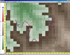
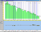
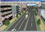
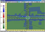
Sample models of estimation example
|
|
|
1st 3D VR SIMULATION CONTEST by UC-win/Road |
 |
|
|
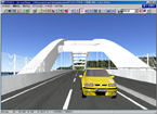
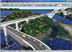
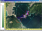
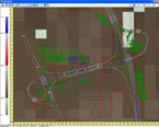
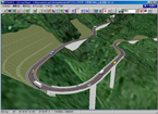
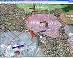
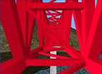
| Kushimoto Bridge and Myouga Loop Bridge (1.6km) to link Oshima with Kushimoto-cho,
southernmost end of Honshu and road data model (0.3km) in Oshima. Kushimoto
Bridge designed by Osaka office of Nippon Koei Co., Ltd. won the Tanaka
Prize of Japan Society of Civil Engineering in 1999. This sample data is
used as proposal of bridge preliminary design. |
| Total extended distance (sub- total A) |
3.12 |
| Man-day (sub- total B) |
4.3 |
| Option work Man-day (sub- total C) |
9.2 |
| Aerial photographs |
¥67,200 |
| Total |
¥850,500 |
|
|
|
|
|
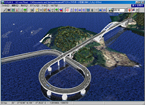
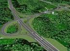
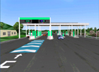
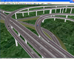
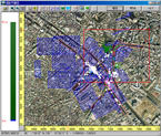
| An expressway interchange is expressed. IC from general road to a tollgate
and IC from the tollgate to expressway are expressed. Total 8 lamps including
the 1st and 2nd IC are created and linked. |
| Total extended distance (sub- total A) |
6.175 |
| Man-day (sub- total B) |
4.6 |
| Option work Man-day (sub- total C) |
15.0 |
| Aerial photographs |
- |
| Total |
¥1,512,000 |
|
|
|
|
|
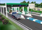
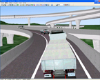
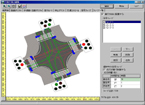
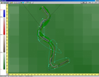
| The Junction has 8 lamps to link inbound/ outbound lane with other with
2 overhead crossing freeways. Complicated alignments where different lamps
merged on the way are run into main lane are expressed correctly. Traffic
flow from all directions can be checked by setting of traffic flow. |
| Total extended distance (sub- total A) |
10.768 |
| Man-day (sub- total B) |
4.1 |
| Option work Man-day (sub- total C) |
6.0 |
| Aerial photographs |
- |
| Total |
¥1,753,500 |
|
|
|
|
|
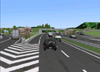
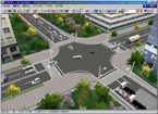
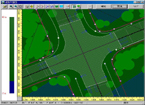
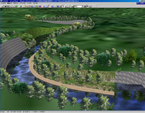
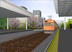
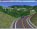
| This is normal grade intersection data. Road extension is 700m. Building
models registered in D.B are arranged in wayside. Pedestrian bridges and
sidewalks on the road, street lights and trees on planting zone are arranged.
Traffic flow and intersection driving route are set. |
| Total extended distance (sub- total A) |
1.0 |
| Man-day (sub- total B) |
4.3 |
| Option work Man-day (sub- total C) |
4.3 |
| Aerial photographs |
¥67,200 |
| Total |
¥367,500 |
|
|
|
|
|
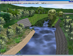
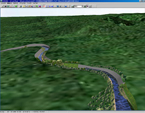
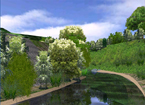
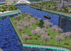
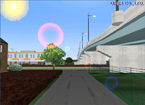
| This is around 600meters of river development data. This is created to
match with nature as a concept image. Trees are planted in river and revetment
which is displayed by a revetment block and partly and a natural revetment.
The function of lakes and marshes are used. |
| Total extended distance (sub- total A) |
0.9 |
| Man-day (sub- total B) |
4.8 |
| Option work Man-day (sub- total C) |
5.8 |
| Aerial photographs |
- |
| Total |
¥346,500 |
|
|
|
|
|
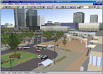
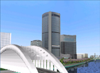
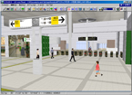
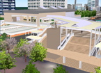
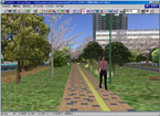
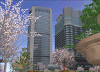
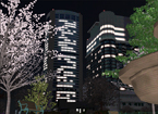
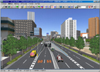
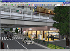
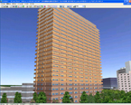
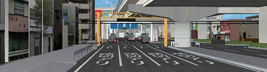
Pedestrian deck (fictions) with Sakuranomiya Station at Kita-ward, Osaka-city
is expressed.
OAP tower where FORUM8 Osaka office locates and Imperial Hotel sharing
entrance part are created as main. 8.99km of extended road, station square
rotary, surroundings, bridges, Osaka Castle, OAP and Okawa are modeled.
Traffic flow, person model and fake light (during night) are expressed. |
| Total extended distance (sub- total A) |
6.43 |
| Man-day (sub- total B) |
4.8 |
| Option work Man-day (sub- total C) |
15.0 |
| Aerial photographs |
¥67,200 |
| Coverage |
¥38,165 |
| Total |
¥1,711,500 |
|
|
|
|
|
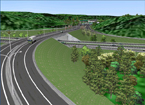
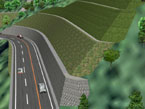
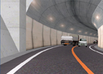
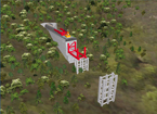
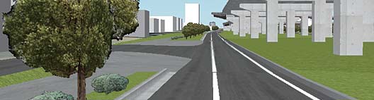
| This is 2.23km of mountain road data. 1 tunnel and 1 bridge are set in
the section. As to creation area, detailed current terrain is displayed,
by creating the terrain patch data corresponding 1 meter mesh from terrain
contour data (DXF). Cut slope / embankment in each side of road, such as
berm are reproduced faithfully. |
| Total extended distance (sub- total A) |
2.633 |
| Man-day (sub- total B) |
5.8 |
| Option work Man-day (sub- total C) |
4.5 |
| Aerial photographs |
- |
| Total |
¥682,500 |
|
|
|
|
|
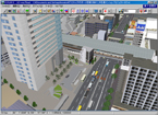
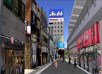
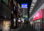
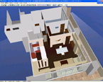
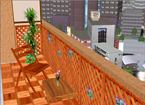
The neighborhood of Nakameguro Station, Meguro-ward is expressed.
GT tower where FORUM8 head office locates, roads, and urban space around
Nakameguro Station are created. Newly built condominiums (fictitious) along
Komazawa Avenue are modeled, assuming the confirmation of interior / exterior
scene. Traffic flow, railway vehicles and person model are expressed. Fake
light textures during night and motion control models are set, too. |
| Total extended distance (sub- total A) |
7.496 |
| Man-day (sub- total B) |
4.8 |
| Option work Man-day (sub- total C) |
30.5 |
| Aerial photographs |
¥67,200 |
| Coverage |
¥76,330 |
| Total |
¥2,467,500 |
|
|
|
|
|
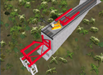
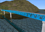
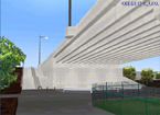
| The data express the bridge erection steps of 560m of road across mountains
and a ravine. All erection steps can be seen for the setting of movable
models. Synchronizing truss erection with crane action provides the clear
erection images and setting of road alignment provides driving images after
construction complete. |
| Total extended distance (sub- total A) |
1.22 |
| Man-day (sub- total B) |
4.4 |
| Option work Man-day (sub- total C) |
10.2 |
| Aerial photographs |
- |
| Total |
¥535,500 |
|
|
|
|
|
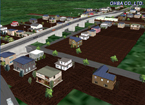
| This is created for by-pass examination plan in developed land of certain
town. This data is used for the scene examination from developed land after
by-pass completion, the check of the difference in height between lands,
the access road check from the by-pass to the land and examination of car
stop installation. It allows checking scenes from arranged standard building
models in developed land. |
| Total extended distance (sub- total A) |
1.98 |
| Man-day (sub- total B) |
4.1 |
| Option work Man-day (sub- total C) |
5.2 |
| Aerial photographs |
- |
| Total |
¥462,000 |
|
|
|
|
|
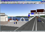
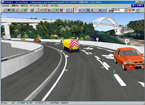
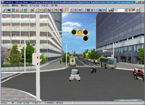
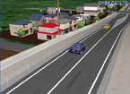
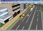
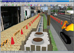
| 100 meters of construction zone within around 500 meters of road extend
distance, and traffic lane regulation related with it, including traffic
lights and signals controlling are expressed. Construction zone is displayed
by arranging models with scene switching. There are 3 phases of scene switching,
including current state. |
| Total extended distance (sub- total A) |
0.85 |
| Man-day (sub- total B) |
4.1 |
| Option work Man-day (sub- total C) |
7.75 |
| Aerial photographs |
- |
| Coverage |
¥31,500 |
| Total |
¥420,000 |
|
|
|
|
|