From Formulation of a Location Suitability Plan to Realization of a "Dynamic Hazard Map".
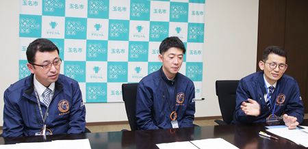
When the aforementioned "Location Optimization Plans" for the city was being formulated in FY 2019-21, the "PLATEAU" project of MLIT was launched (in FY 2020), in addition to the national government's promotion of DX. In the process of discussing how to integrate soft measures for areas at high risk of flooding in the plan's disaster prevention guidelines, the city focused on the solution development projects for the regional issues using 3D urban models for the PLATEAU project. On the other hand, they had the opportunity to experience UC-win/Road for the first time at a MLIT subworking group related to the project. They came up with the idea of using UC-win/Road and 3D urban models to promote soft measures aimed at raising disaster prevention awareness through visualization of disasters and evacuation simulations. They expressed their participation in the project with a view to applying their knowledge about this to community development and urban planning. In April 2022, UC-win/Road was adopted, and the project was launched, recalls Mr. Nobuhiro Yasuda, Chief Engineer, Shin-Tamana Station Area Development Promotion Section, Urban Development Division, Construction Department of the city.
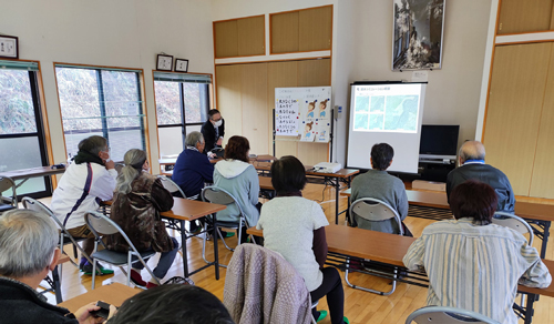 |
Workshops were held for neighborhood residents to raise their awareness of
disaster prevention and to use the data in disaster prevention lectures. |
 |
 |
 |
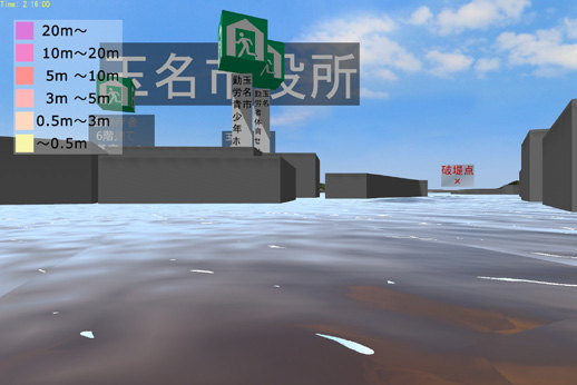 |
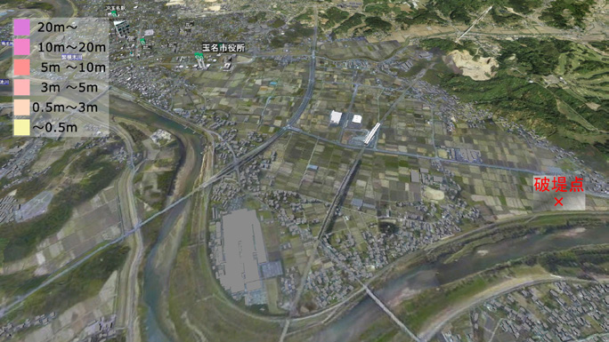
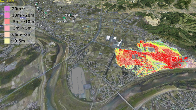
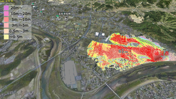
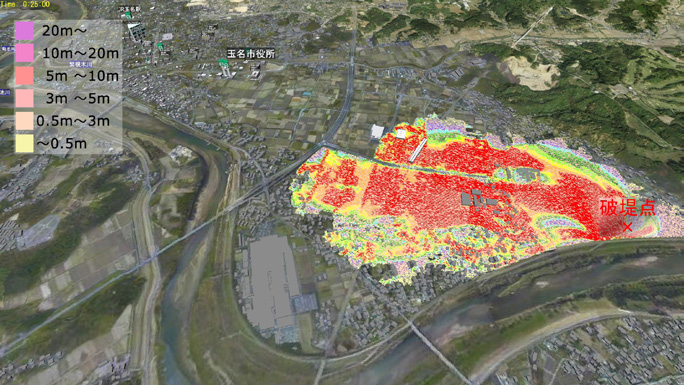
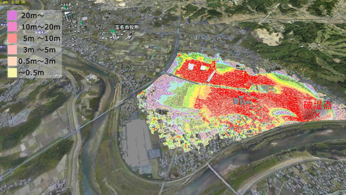
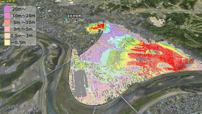
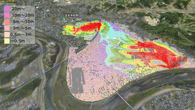
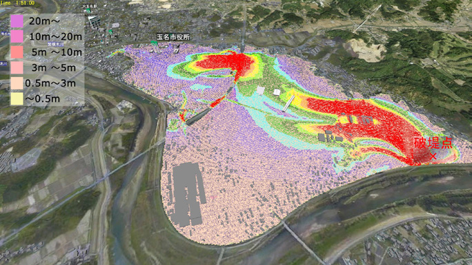
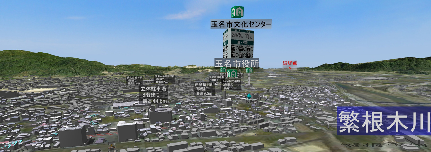
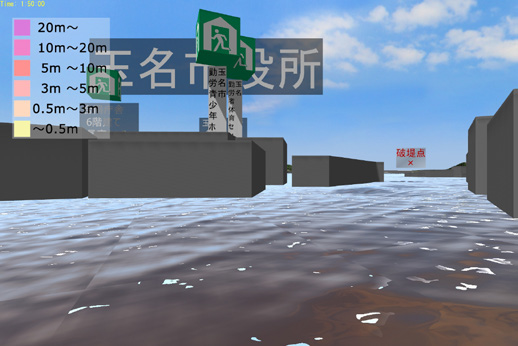
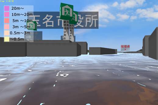
| Visualization of disaster risk by real-time representation of the range of inundation and changes in water level conditions on the 3DVR space utilizing the 3D urban model. |
First of all in this effort, the city realistically reproduced the current situation of the city in 3D VR using the 3D urban model of PLATEAU with UC-win/Road. Based on this model, a simulation of flooding and evacuation was created. Based on this, simulations of inundation and evacuation were created. It was intended to use them for identifying the areas at risk of levee breaches and flooding, and having local residents realize the flood damage through a VR experience, in order to raise disaster prevention awareness and improve evacuation guidance.
After the completion of this work, the city implemented demonstrations in December 2022 for Professor Riken Honma, Graduate School of Science and Technology, Kumamoto University, who is supervising the city for the efforts to visualize disasters, and other concerned people within the city government, and in February 2023 for Mayor Kurahara, the concerned people within the city government, and some citizens in the area. During the demonstration, Professor Homma described the results as a "dynamic hazard map" that allows users to experience the ever-changing hazard map on the 3D urban model, as opposed to the existing static (non-moving) paper or 2D hazard maps. He also mentioned that this could be one of the new disaster prevention tools. Mr. Yasuda noted that other participants also evaluated the demonstration as more intuitive and easier to understand than before.
|
|
|
|
|
|
| Time history simulation of the range and depth of inundation in the event of a levee break and flooding in response to the largest possible rainfall |
Building a Digital Twin for More Advanced Utilization in Disaster Prevention and Community Development
The products of the FY2022 use case project on disaster visualization using 3D urban models will continue to be used in future lectures on disaster prevention and so on. Thereby, they will be used as a support tool for fostering disaster prevention awareness among citizens and for developing My Timeline (a disaster prevention action plan for each resident). At the same time, the developed flood simulation will be published on the city's website using Story Editor, and the results of the flood analysis will be published on PLATEAU VIEW," Mr. Yasuda explained.
Furthermore, from the next year onward, they will start building a digital twin environment using the 3D urban model. In specific, they will focus on the "Takaseura River Iris Festival", which is usually held from mid-May to early June and attracts a total of around 100,000 people. They install Wi-Fi packet sensors throughout the city to measure visitors' travel routes. Then they will reproduce and analyze the acquired human flow data on the 3D urban model and import the data into UC-win/Road to combine 3D VR and human flow to visualize real-world phenomena in a more realistic manner. He says that through the simulation forecasts according to the changes in the 3D spatial environment, they desire to plan to build tools that contribute to not only disaster prevention such as evacuation guidance during the time of disaster but also park management such as layout plans of facilities and structures, town development, or tourism promotion.
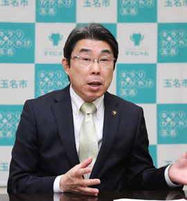
Meanwhile, Kouki Hirokawa, Assistant Manager of Urban Development Division, Construction Department of the city, who also serves as Section Chief of Shin-Tamana Station Area Development Promotion Section noted the potential of using 3D urban models and UC-win/Road for infrastructure development around the station, though he says it is still in the study stage. Besides, Mr. Nakao, Division Manager pays attention to the benefits of using them in the redevelopment of the central urban area. He hopes that Mr. Yasuda, who is leading the practice of this initiatives of this project, will spread his expertise to other staff members.
 |
| Source: Tamana City website |
 |
 |
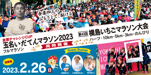
The Tamana Idaten Marathon, the first full marathon
in northern Kumamoto, and the Yokoshima Strawberry Marathon
held simultaneously on February 26 (Sunday) at the place
related to the father of the marathon, Shiso Kanakuri.
Source: Tamana Idaten Marathon/ Yokoshima Strawberry Marathon HP |
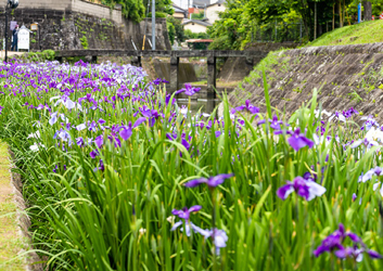
The 31st Takaseura River Iris Festival,
May 19 (Friday) to June 3 (Saturday), 2023.
*Main event: May 27 (Saturday),
postponed to May 28 in case of rain.
Venue: The Takaseura River Waterfront Green Park, Tamana City |
Digital City Using UC-win/Road Becoming a "Common Language" for Citizen Engagement
Mr. Nakao, Division Manager evaluates that the resulting 3D VR is "more beautiful and realistic" than he expected. Furthermore, he noted the software's characteristics that allow the staff members to apply to further uses for themselves if only they become proficient in using UC-win/Road. For example, he imagines the use of UC-win/Road in driving simulations, where people can enjoy the game-like experience while gaining a better understanding of the intentions of the government.
Mr. Yasuda has been exclusively in charge of operating UC-win/Road within the city government. Based on this experience, Mr. Yasuda says that it is desirable to first become familiar with the electronic maps through GIS (Geographic Information System) software, and then move on to UC-win/Road. He also believes that in the future it will also be necessary for municipalities that their staff members are able to create what is necessary on their own.
In fact, if they can create their own digital city, the scope of its utilization should expand. For example, visualization of the specifics of a policy will enable intuitive understanding within the city government as well as by citizens who are not specialist, and the city will be able to get citizen responses. Mr. Yasuda expects that the digital city will become a communication tool that facilitates citizen participation as well if they accept the citizens' reaction firmly and improve in presentation through the interaction such as thinking "I' do like to show things like this next time".
"I believe that the digital city created by using UC-win/Road will become a 'common language' between the municipal government and citizens, evolving as a tool for citizen participation."
|