
April 24th, 2020
FORUM8 Co., Ltd.
| FORUM8 has released
UC-win/Road Ver.14.1 4D simulation for work progress management and improved drawing processing available for the deep learning |
FORUM8 Co., Ltd. (2-15-1 Konan, Minato-ku, Tokyo. President Yuji Ito. URL: http://www.forum8.co.jp/english/) has released the 3D virtual reality software UC-win/Road Ver.14.1.
UC-win/Road has been utilized in a wide range of fields such as city planning, traffic planning, and research on autonomous driving after its first version was released in 2000. It won the 2002 Software Product of the Year (Ministry of Economy, Trade and Industry), and won The 8th Monodzukuri Nippon Grand Awards METI Minister's Award for its connection acceleration among various technologies and industries by its open data cooperation in 2019.
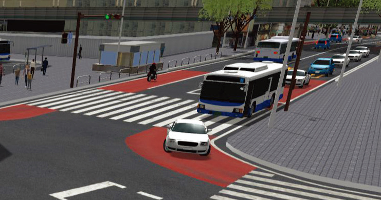
The latest UC-win/Road Ver.14.1 covers the 4D simulation that can be used for the work progress control. Several data creation functions such as the drawing processing available for the deep learning image analysis have also been enhanced.
|
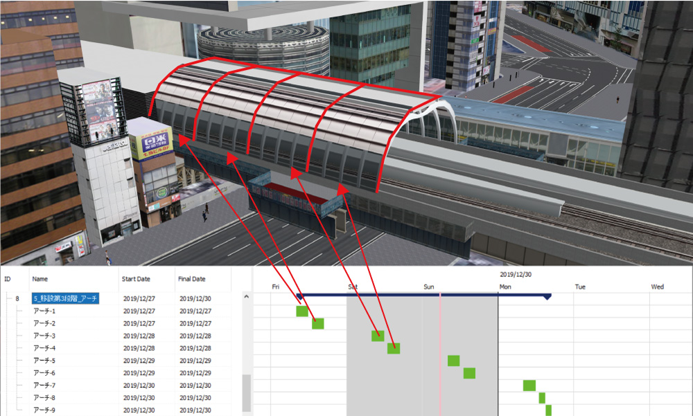
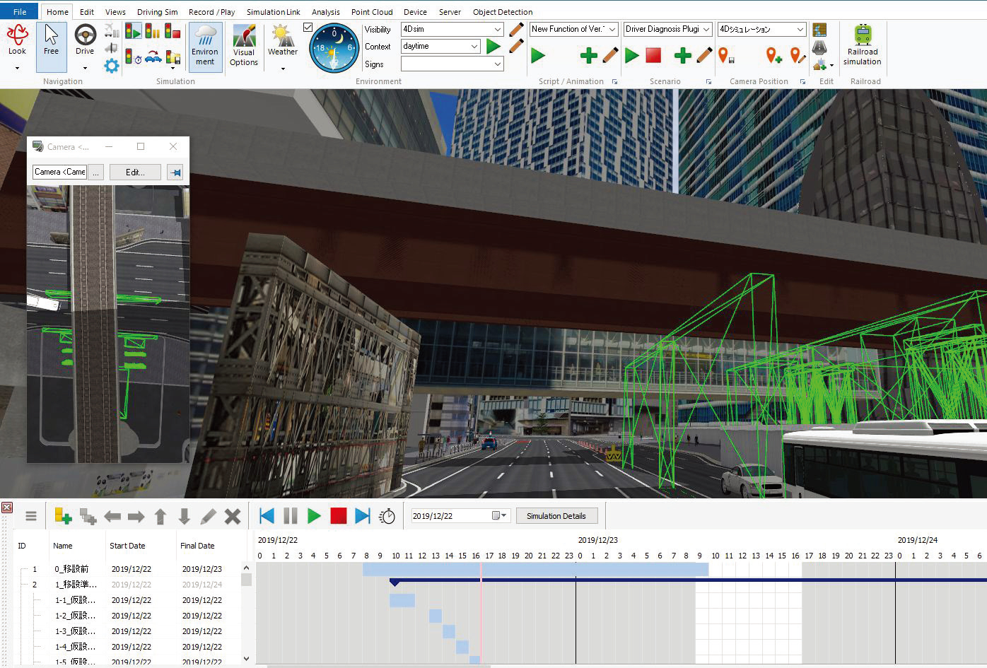
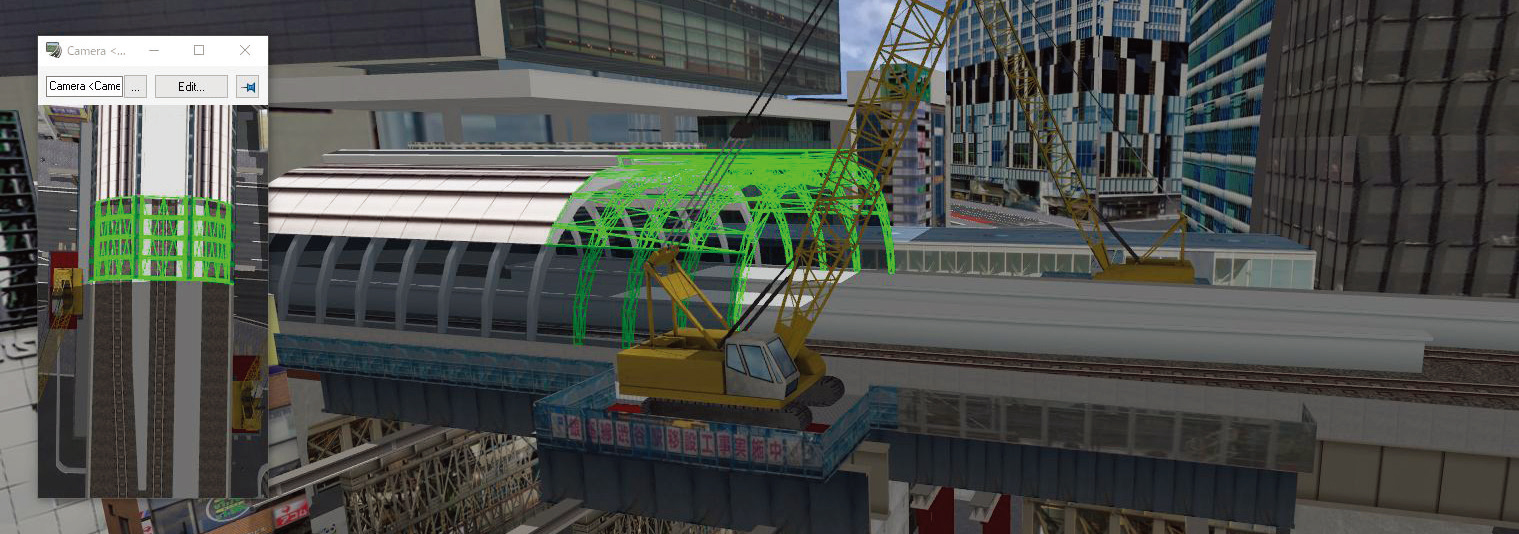
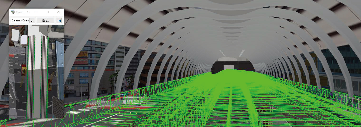
The 4D simulation function (4D Simulation Editor Plug-in option)
allows you to set behaviors of models as the time changes. 4D
simulation and progress management are available by setting
appearance and disappearance of models, movement of models, and
camera positions on specified date on the Gantt chart. The 4D simulation function gives you several benefits. For example, the procedure changed in 3D space can be reflected on the progress sheet immediately that results in reducing mistakes on submitted materials, it is easy to avoid interference between parallel tasks, and showing simulations according to a plan makes the relationship with real time easy to understand. In addition, viewers can easily confirm and understand not only procedures but plans and construction period. |
|
 |
 |
 |
|
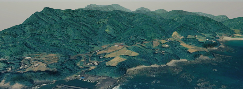
As the enhancement of the data creation, the altitude interpolation method can be selected from bilinear with primary interpolation and bicubic with cubic interpolation. Fine mesh reproduces the smooth terrain surface.
 |
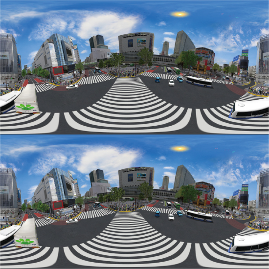
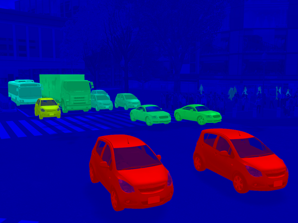
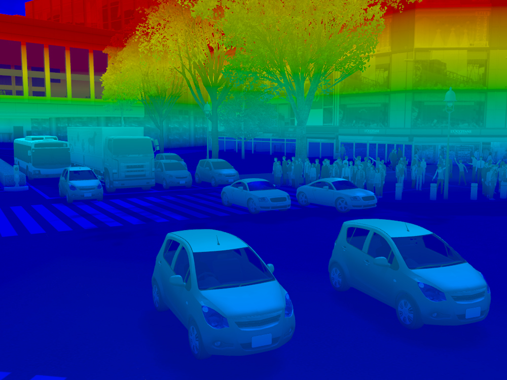
The rendering functions were improved in the UC-win/RoadVer.14 released in October 2019 and the 360-degree image export and the shader-used coloring processing based on object information were added. In the Ver.14.1, original VR CG image and custom rendering image can be output at the same time.
 |
 |
 |
|
Output of 360-degree image (Left) and rendering customization by the custom shader sample renderer (Right) |
|
 |
 |
[Related Information]
![]() VR
Design Studio UC-win/Road Product Information & New Functions
VR
Design Studio UC-win/Road Product Information & New Functions
https://www.forum8.co.jp/english/uc-win/ucwin-road-e1.htm#new_func
![]() Press
Release: FORUM8 has released VR Design Studio UC-win/Road Ver.14 (November
20, 2019)
Press
Release: FORUM8 has released VR Design Studio UC-win/Road Ver.14 (November
20, 2019)
https://www.forum8.co.jp/forum8/press/press191105-e.htm
![]() Press
Release: FORUM8 is awarded The 8th Monodzukuri Nippon Grand Awards METI
Minister's Award (January 8, 2020)
Press
Release: FORUM8 is awarded The 8th Monodzukuri Nippon Grand Awards METI
Minister's Award (January 8, 2020)
https://www.forum8.co.jp/forum8/press/press191227-e.htm
![]() UC-win/Road
won the 2002 Software Product of the Year (in Japanese)
UC-win/Road
won the 2002 Software Product of the Year (in Japanese)
https://www.softic.or.jp/spoty/2002/honored_2002.htm