VR Data For the Competition Site of The 11th Virtual Design World Cup VR Data For the Competition Site of The 11th Virtual Design World Cup
"Phuket Smart Resort Design Challenge!"
In the VDWC, the 11th international competition for students, in addition to VR simulations, students are required to submit data that combines at least two or more design results using the target software, such as traffic analysis, bridge/tunnel/road structure, building structure, environment, disaster prevention and evacuation analysis. The theme of this year's VDWC is "Phuket Smart Resort Design Challenge!", and Dr. Walaiporn NAKAPAN (Asst. Prof. of Faculty of Architecture, Rangsit University) supports the competition as a local advisor.
|
Local Advisor: Dr. Walaiporn NAKAPAN (Asst. Prof. of Faculty of Architecture, Rangsit University)
|
 |
|
She is a registered architect of the Association of Siamese Architects (ASA), currently a lecturer at the Faculty of Architecture, Rangsit University. Her main activities and researches are related to computational design, parametric design, free-form architecture, and digital fabrication.
She had previously held positions as the Program Director of the Master of Science Program in Computer-Aided Architectural Design, the Program Director of the Master of Architecture in Computer-Aided Design, and the Director of Center of Innovative Learning at Rangsit University. She has also served as a secretary, officer, and editor of the Association for Computer-Aided Architectural Design Research in Asia (CAADRIA), and an honorary Secretary at the ACAE (ARCASIA's Committee of Architecture Education).
|
|
■Phuket, a popular scenic tourist spot
Phuket lies off the west coast in the Andaman Sea, which is in the east of the Indian Ocean and has the boasting high transparency and beautiful coral reefs, and is one of the most prominent resorts in the world. Phuket is often called "Pearl of the Andaman Sea" because of the beauty of the emerald sea and the white sandy beach the resort has to offer, and a lot of tourists from all over the world come to visit Phuket throughout the year. With an area of 543 km2, it is the largest of Thailand's islands and is long and narrow from north to south, with most of the popular beaches located along the west coast of the island.
While the beach often comes to mind as an international tourism spot, the 77% of the island is mountainous terrain with highs and lows, so it has developed into a multi-resort area where tourists can experience not only marine sports, but also golf, trekking, river rafting, and jungle exploration. International marathons, triathlons, and Asia's largest international yacht race have been held in the island. Phuket International Airport, about 1 hour and 20 minutes by air from Bangkok, is located in the northwest of the island, and a bridge on the north side of the island leads to the Thai mainland. There is also a direct bus that runs between Bangkok and Phuket in about 14 hours.
The entire island compose Phuket Province, and Phuket town, the capital of the province in the southeastern part of the island, has a long history of tin mining and international trade. In the area called "Old Town", which is the center of politics and economy, you can see the unique city appearance with the old Chino-Portugal architectures. Among many beaches in the Phuket island, Patong Beach was the first developed and is the most popular with full of crowd. There are hotels, restaurants, nightclubs, and stores along the 3km long sandy beach and the beach road, and people are attracted not only by marine sports but also entertainments.
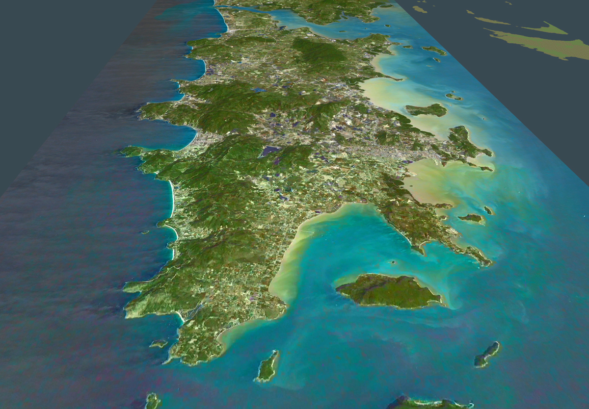
▲Overhead view of Phuket island |
|
 |
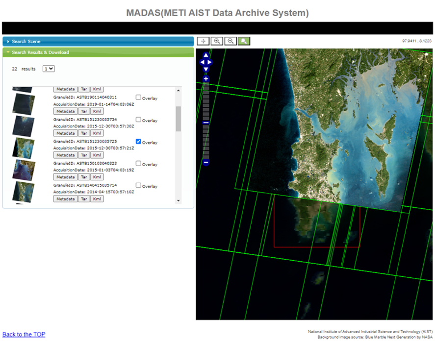 |
| ▲SRTM terrain data import |
▲Satellite data (ASTER-VA)* |
* imagery courtesy "NASA/METI/AIST/JSS ASTER"
*Published by The National Institute of Advanced Industrial Science and Technology (AIST)
(https://gbank.gsj.jp/madas/?lang=en) |
■Design a smart resort using island-wide base data
We incorporated the entire island into VR data so that all the participating teams can configure their designs anywhere in the island to make their own smart resort, the theme of VDWC2021. To cover the long and narrow shape of the island with about 50km north-south and 20km east-west, it is the large-scale topographical data including the surrounding area, which is about 85km north-south and 40km east-west. The terrain is generated by importing from SRTM data, and pasted sattelite images are ASTER-VA data from MADAS (METI AIST Data Archive System). We retrieved the images by specifying the region and the amount of cloud, and from the search results, we selected several clear images from the recent data, which are combined with ortho-rectified data in GeoTIFF format.
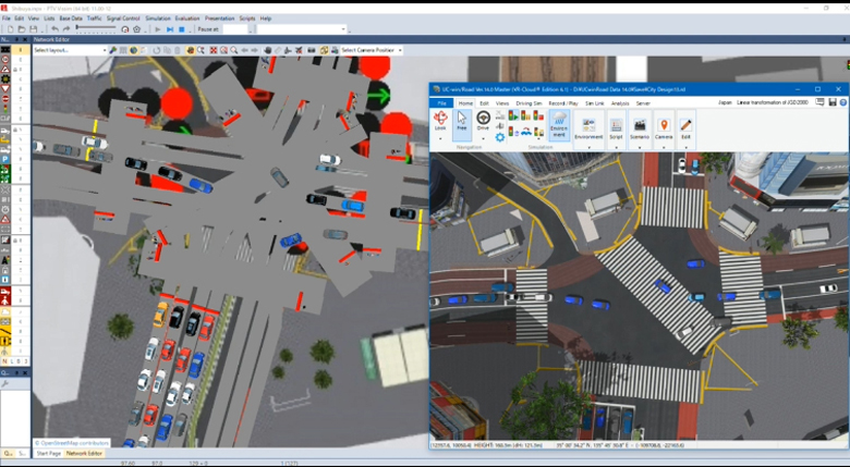
We set up roads and intersections, signal control, traffic flow, pedestrians, flight paths, contexts, scripts, and scenarios for the participating teams to use as reference in creating their own data. The 30-second script introduces the main landscapes on the island.
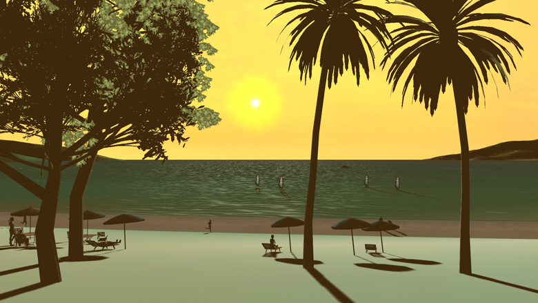
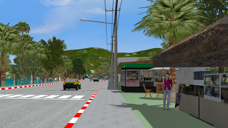
Patong Beach was selected as the representative beach for the sample image, and the sandy beach, plants, cityscape, and evening view were expressed. Along the beach road (Thawewong Road), we placed models of buildings and open cafes that evoke the image of a tropical resort.
This sample data can be viewed on the VDWC official website via VR-Cloud®. Please access from your PC or smartphone (AndroidTM only).
■Create unique data using specified software (free rental products)
The judging criteria for this competition is to create data that combines multiple design outcomes such as VR, transportation, evacuation, etc.
Competitors are expected to create planning and design based on the provided base data, making the most of the target software.
● VR Design Studio UC-win/Road
(Including plugins for Aimsun linkage, VISSIM linkage, Micro Simulation Player, parking lot model import, assessment, tsunami, debris flow, work product, point cloud, erc.)
 |
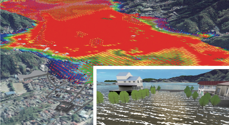 |
| ▲Visualize results of traffic flow analysis (VISSIM) |
▲Dynamic 3D simulation of tsunami/flooding analysis result (xpswmm) |
● Shade3D
3DCG software covering modeling, rendering, animation, and 3D printing
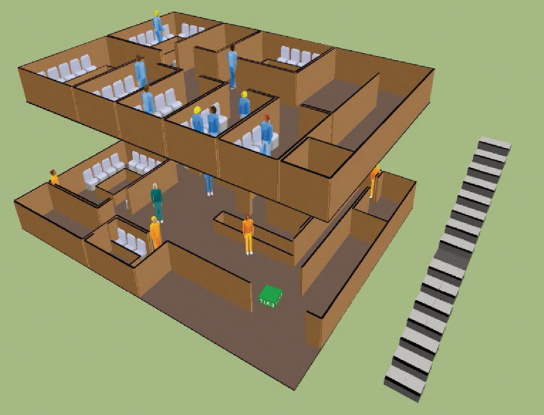
● EXODUS/SMARTFIRE Analysis Support Service, Evacuation Analysis Support Service
|