 |
 |
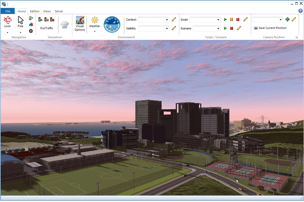
| ▲Figure 1 VR-Cloud® | |
| New Products | |||||||||
|
|||||||||
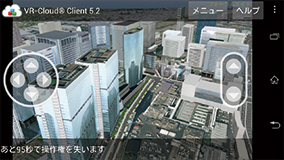
| VR-Cloud® Support by Default |
Aimed at giving users the ability to publish their VR data on the
internet, to perform coordinated design discussion, or even remote
interactive conferencing, VR-Cloud's server features will be
available to both the UC-win/Road Advanced and Ultimate versions by
default. Users can now leverage on this change to perform more
effective project presentation through remote TV conferences, or simply
attract more audiences who lack a powerful computer.
|
||||
| Improved UI |
| We will be replacing the menus and toolbars with a new ribbon menu
design. This change will help users locate the commands needed more
intuitively, increasing work efficiency. UC-win/Road's new menu layout will consist of the following ribbons: File, Home, Edit, View, Server, an Plugin. All functions are directly placed under its corresponding ribbon category. WIth easy-to-understand graphical icons, the complicated interface pre-version 11 will become much smoother to use.
Another minor but handy change is the ablity to load textures in the texture folder that have been modified without first restarting UC-win/Road. Furthermore, the specificying of textures is now integrated into one single window, with following features also incorporated:
|
| Oculus Rift Support |
Oculus Rift is an enclosed 3D head-mounted display developed and
marketed by Oculus VR. It is one of the first and few headsets
available that provide users with a wide field of view (up to 110
degrees). Through the use of the Oculus Rift, it will provide the users
with a higher sense of immersion and realism.
To achieve stereoscopic display, the images need to be outputted and rendered individually for each eye, with considerations of parallax. Furthrmore, in order to make the small lens displaying a seemingly wide area, the videos are deliberately distored. Combined with the embedded accelerometer, allows user to synchronize their head movements with the video they are seeing, which is great for navigation or driving in VR. HMDs grant users an unparalled sense of spatial and depth perception, and is thus very suited for visualization of simulations. |
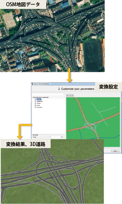
| OpenStreetMap Support |
|
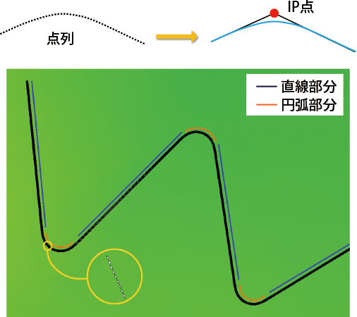
| Curve Calculation Function |
|
| Extended 3DS Export Support |
| When exporting files into 3DS files, further information such as
objects' coordinates and many landscape settings can also be added into
the exported XML files. The extended information in the exported 3DS
models and XML files allow a quicker and more convenient import of
UC-win/Road data into other software as well. Furthermore, exporting of objects such as road signs, backgrounds, and power poles have been added. |
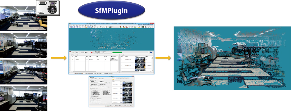
| SfM (Structure from Motion) Plugin |
| SfM(Structure from
Motion) is the name of a technique of generating point-cloud data
from a series of photo through a regular digital camera, which makes 3D
data modeling much more accesible. SfM plugin allows photos to be
loaded into UC-win/Road and analyzed to generate models. Using the SfMPlugin mainly involves the following steps:
This plugin may be useful in recording and recreating road structures and objects by car-mounted cameras. Or alternatively, using UAV to fly around large building complexes.
|
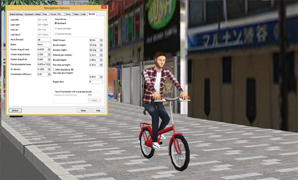
| Bicycle Simulation |
The Log Export Plugin will also be compatible with bicycles. Information such as position, tilt, and speed are exported and may be used for researches. Flovel's cycleStreet bicycles introduced in earlier version can also be linked with UC-win/Road through a plugin. Pedalling on the pedals that is connected to a PC allow control of bicycles as well. All parameters, such as the RPM, of cycleStreet are reflected, to allow precise bicycle speed controls. |
| Improved Rendering Engine |
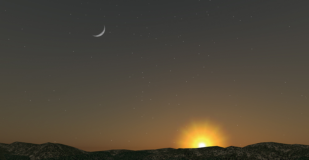
| Shadows have now been improved. The coding is now more optimized
allowing higher speed rendering while maintaing quality. Other than
shadow simulations, the improved shadows greatly increase the sense of
presence and spatial perception necessary for driving simulation and
realism. The shadow's sharpness, contrast, and blur can also be
adjusted for cloudy conditions. Ripples in lake water has also been improved, with dynamic calculation of texture and reflectivity for more realistic water graphics. A new skydome model is now available in addition to the previous method of applying existing sky textures onto it. This allows more liberty and intuition in controlling the colour and sunlight of skies, through simply progressing the time. In the future versions, we will focusing on expanding the cloud models. The overall rendering engine has also been updated to allow more customizability. With the rendering process now consolidated, customization of every single rendering process is now possible. In the future, or via the SDK currently, it will be possible to add pre- and post- processing of all rendering steps. This will make it easier for developing features that are compatible with techniques such as fisheye lens effects, ambient occlusion, and edge blending.
|
||||||||||||||
| A Message from FORUM 8 |
| These are the new features that will be introduced in the new version of UC-win/Road. We will continue to collect customer demands and continue to improve and perfect ourselves. |
| (Up&Coming 2016 New Year Edition) | ||
 |