New Products
UC-win/Road UAV Plug-in Ver.3 Simulation
Linkage with 3DVR enables flight plan creation, remote control, and log acquiring
●New Price
●Release
US$3,000
Oct. 2017

 UAV Plugin 2.1
Ver.2.1 has realized a more simple mission creation for mapping. New tabs are added to the mission editing screen, and a mapping mission can be created based on multiple parameters from mission predicted results.
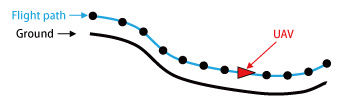
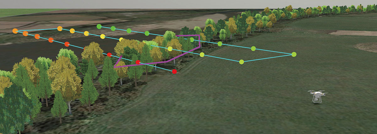
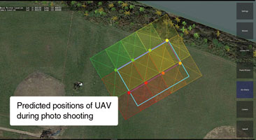
Parameters such as mapping position and range, overlap coefficient, and pixel resolution can be set, and shooting range and expected flight path can be checked in the mission preview (Fig.1).

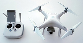
After confirming the preview, click "Start" button to start flight. The UAV automatically takes off, flies according to the defined path, and shoots photos. It automatically lands on the last shooting position or the place of the takeoff.
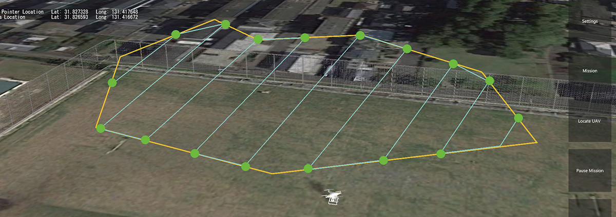
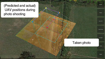
In the preview of the mapping mission, thumbnails of images taken during the flight mission are displayed over the actual positions (Fig.2). This allows you to check the mapping mission result and correctness of photo before downloading in full resolution.

pic1 pic2
Fig.1 Preview screen of mapping mission Fig. 2 Preview of completed mapping mission
 UAV Plugin 3.0
This version has improvements for more friendly system. Movement corresponding to undulating surface and obstacles like buildings and trees around are under developing. The followings are the planned new features.

  1. Import / Export of flight mission in the standard format (KML)
  2. Automatic height adjustment of each passing point according to altitude or obstacles (Fig.3) enables photo shooting from the constant height despite landform.

    Fig.3 Automatic height adjustment according to landform

  3. Batch setting to all selected passing points. For example, you can select several passing points and increase elevation value of all (Fig.4).

    Fig.4 Batch setting applied to multiple passing points

  4. Definition of mapping area done with rectangle by mouse click in current version can be done with polygon (Fig.5).

    Fig.5 Mapping area definition with polygon

Moreover, support of DJI Phantom 4 Pro (Fig.6) and DJI Mavic Pro (folding compact UAV: Fig.7) is undergoing. Different from the previous supported hardware (DJI Phantom 3 Advanced, DJI Phantom 3 Professional), these drones can avoid collision thanks to the equipped distance sensor. It allows you to operate the UAV within easy reach of objects to obtain details, and it is expected to be useful for checking of infrastructure.

drone   drone
Fig.6 DJI Phantom 4 Pro   Fig. 7 DJI Mavic Pro
(Up&Coming '17 Summer issue)
Back
Up&Coming

FORUM8