| New Products & Service | Support/Service | ||||||||
|
●Price Separate estimation ●ReleaseNovember 2020 |
|||||||||
|
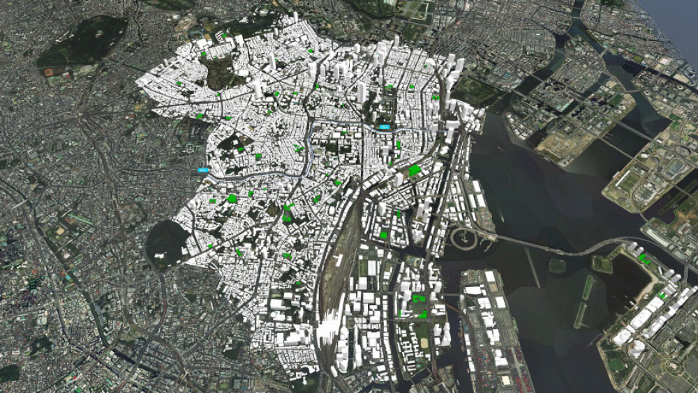
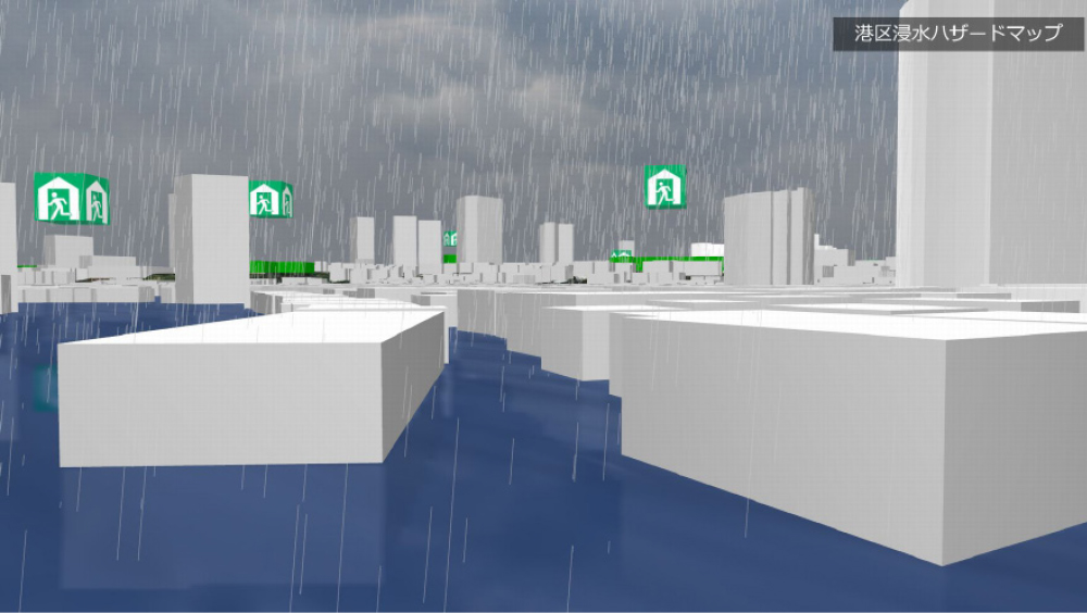
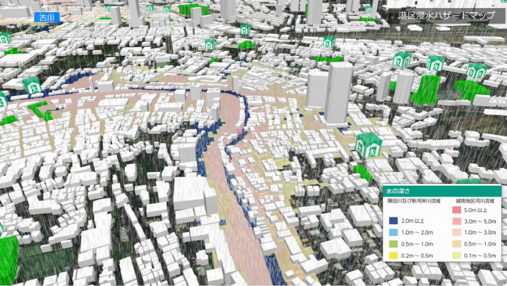
Flooding Hazard Map by 3D VR Simulation We started to provide a "3D VR flood hazard map service" that allows you to check disaster simulations and evacuation routes on a 3D map. In the past, a 2D map was usually used for creating hazard maps, but it had the problem of being difficult to grasp the damage images and the status of evacuation routes intuitively, and it cannot be said that it was always used effectively. We built a hazard map based on 3D VR and visualized it in cooperation with our high-precision real-time simulation of inundation, flooding, and tsunami in order to complete an easy-to-understand evacuation guidance explanation. Terrain, roads, and buildings reproduced with 3D models help ordinary people without specialized knowledge, people from other countries, and children to understand damage and change in the situation intuitively. Thus, it can be effectively used in disaster prevention education and evacuation drills. Simulation Examples As an example, we created a 3D VR simulation reproducing the Minato City Flood Hazard Map covering the whole area of Minato-ku, Tokyo. This hazard map shows the areas assumed to be flooded at the time of heavy rain that greatly exceeds the drainage capacity of sewers and rivers. Minato-ku is divided into the Sumida River and Shingashi River basin and the Jonan area basin including Furukawa River. The VR data shows the area expected to be immersed when Furukawa River overflows in detail, and you can grasp situations by checking the legends showing the depth of water as well as the locations of shelter seen from the bird's-eye view and the water level model of flooding. As shown in Fig. 1, the overall model is composed of the GSI tile aerial photograph released by the Geographical Survey Institute, the 5m mesh digital elevation model, and the building shape data using OSM (OpenStreetMap) to recreate the terrain and buildings in the whole Minato ward. In addition, the buildings in green in Fig.2 mean the shelters for the residents. The 3D symbols of shelter can be seen from any angles and helps the evacuees to find and reach the evacuation spot.
The water level is set based on the hazard map of Minato Ward, and changes in the water level is expressed in chronological order. Seen from the ground perspective, you can check and feel the immersed range and depth while comparing it with the terrain and buildings to sense danger. In the satellite view, you can check the inundation depth and safe areas shown in different colors and it helps you to determine your evacuation route. Since the flooding situation in the simulation changes over time, you can also grasp which refuge route would become impassable at which timing.
Created data can be published on the internet via VR-Cloud® and can be viewed on Windows PCs and Android smartphones and tablets. As an evacuation drill, it can be used to confirm evacuation routes while viewing the VR, and residents can share information each other by using the note function. Future Development It is said that creating a 3D hazard map takes a lot of time because it needs importing detailed information of regional geographics and rivers. With the UC-win/Road, you can utilize GIS and open data to create a simulation in a relatively short time. This application can also be used to support the disaster and evacuations planning which can be used to build a city that is resistant to flood damage by examining the flood control measures in advance. We hope that this service will contribute to local disaster mitigation measures and emergency correspondence as the number of flood damage which we have never expected or experienced are increasing. Reference |
|||||||||

| (Up&Coming '21 New Year issue) | ||
|

