| New Products & Service | Simulation | ||||||||||||
●PriceUltimate:USD17,200 ●ReleaseJuly 2021 |
|||||||||||||
|
This page describes the main improvements in UC-win/Road 15.1.0 released in July 2021. 4D Simulation The following features for scheduling have been added. These functions help editing tasks efficiently, planning schedule, and checking progress.
For example, in a 4D simulation of soil transport using these functions, it is possible to simulate how many dump trucks are most efficient by defining a dump truck as a task resource, and defining variables such as the overall soil volume, the amount of earth transported per truck, and the mining speed, and then automatically adjusting the schedule for the transportation task.
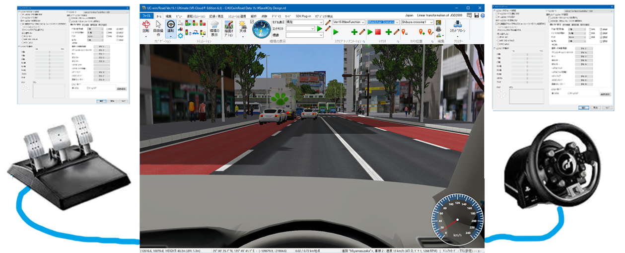
IFC Model The drawing method of the rebar data can now be selected between polygons and lines. Lines can draw with a light processing load, while polygons can draw an accurate rebar diameter. In addition, the versatility of reading the composition of spatial structures and geometric shapes in IFC data has been improved. Game Controller Option Multiple game controllers can now be connected to a computer and be used simultaneously. When multiple devices are connected, it is possible to select the device to be used and set up cooperation with each simulation individually. For example, users can use different devices for steering wheel and pedals at the same time.
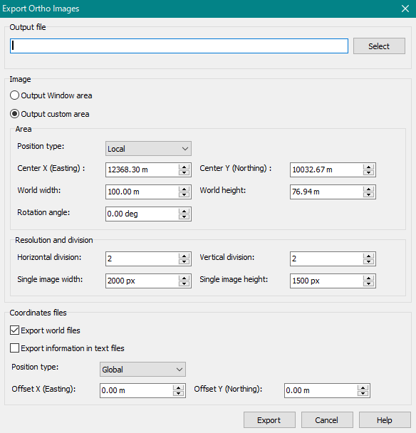
Output Orthoimage A feature to output orthoimages to the 2D view screen has been added. This can be used when it is required to create data that matches the coordinates of the UC-win/Road project in an external simulation program. Users can output orthoimages in PNG, JPEG, and BMP formats and can set the range to be output to the entire 2D view or any customized area in the output settings. For customized output area, it is possible to set the image center coordinates, world width, world height, and rotation angle, as well as to split the image and set the resolution of the split image. It is also possible to output the set coordinate information to a world file, which can be easily loaded into an external simulation program that supports world files.
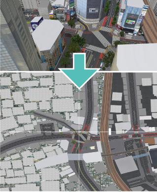
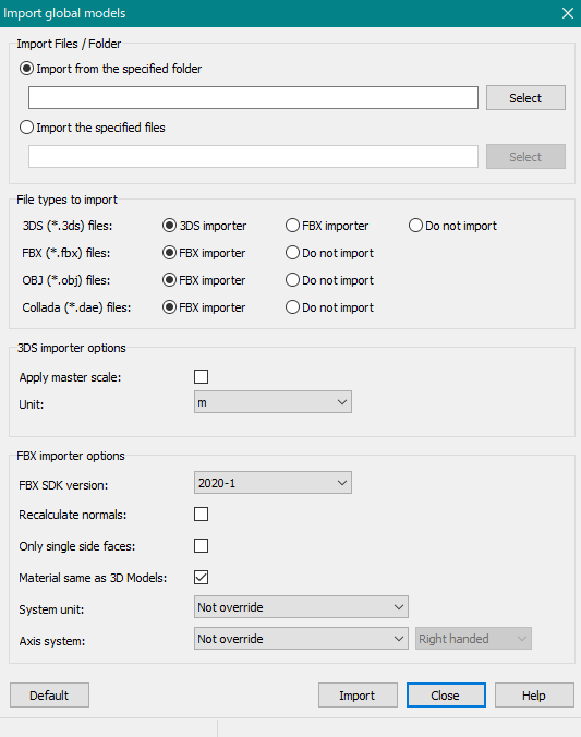
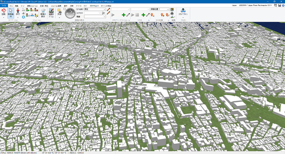
Import Global Models A function has been added to import and place 3DS, FBX, OBJ, and Collada model files with global coordinates in a batch. It can be used from "File" - "Import" - "Import global positioned models". It is useful when importing multiple models with coordinate values, such as PLATEAU data, at once.
Version Update for Linkable Software The following plugins can now be linked with newer versions of external software.
Cluster The functions of UC-win/Road standard editions (Standard/Advanced/Driving Sim/Ultimate/CIM Lite) can now be used in environments where the cluster client or multi-user client licenses are available. |
|||||||||||||

| (Up&Coming '21 Fall issue) |
|
|

