To survey, manage, maintain and inspect approximately 5,000 miles of highways
within the State more efficiently, Hawaii DOT, along with their sub-contractor
Mandli Communications Inc., implemented a data collection process based
on a combination of digital photography and LiDAR (Light Detection &
Ranging). The objective being the development of a photo-log and the 3D
measurement of roadway assets.
In collaboration with FORUM8, Hawaii DOT added color to the point cloud data collected, using pixel data from the photo-log images of the target roads and surrounding structures. This was achieved using the point-cloud Photo Processing Extension plug-in (PPE) developed by FORUM8.
The colored point cloud data was then imported into VR-Design Studio (formerly known as UC-win/Road), FORUM8's real-time interactive 3D VR simulation and modeling software.
A 3D VR simulation environment of the target area was built using the colored point cloud data along with shapefile information, terrain data and aerial ortho-photography, all of which were imported into VR-Design Studio. The result being to help take the DOT's highway management/maintenance program to the next level.
Goro Sulijoadikusumo, the Hawaii DOT Highways Planning Survey Engineer gave a thorough explanation of the application of this photo-log PPE at the FORUM8 International VR Symposium held on July 8th 2014 in Hawaii.
 |
 |
|
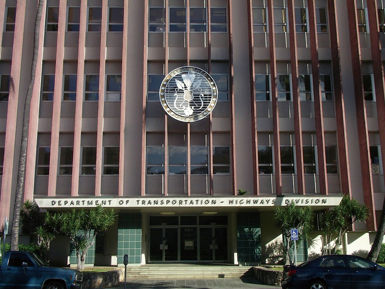
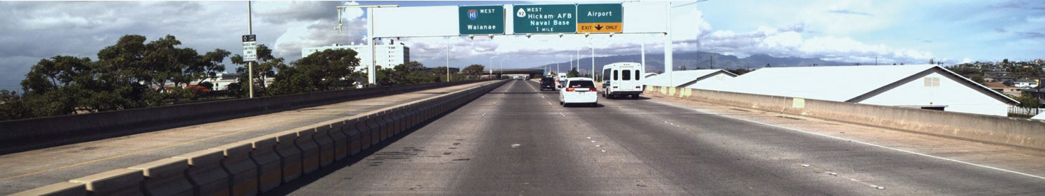
| Hawaii DOT - Highways Division | A highway on the Oahu Island |
| Recording highways using photo-log images and point cloud data |
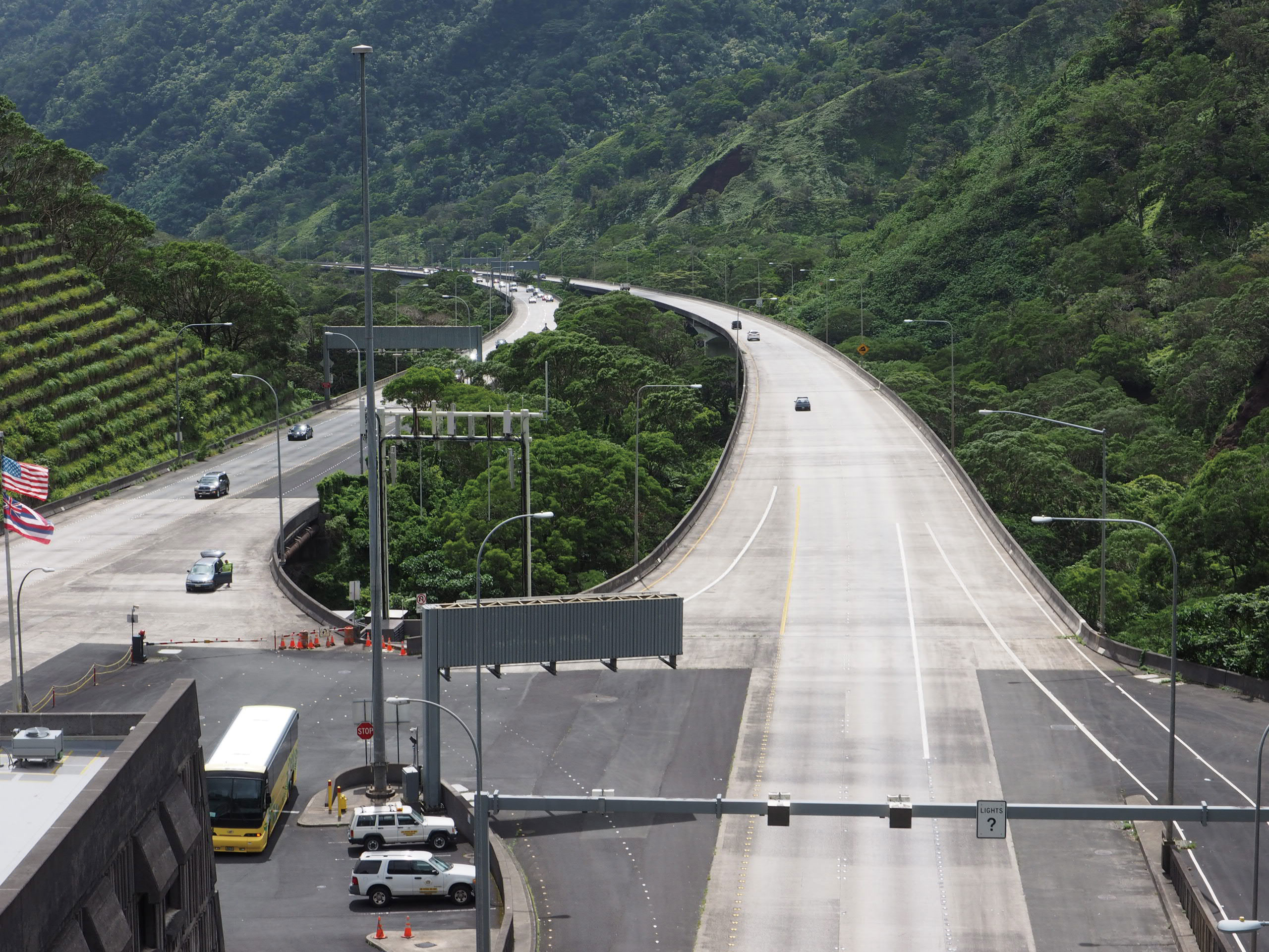
Roads managed and maintained by Hawaii DOT have a total length of approximately 5,000 miles over a total of 6 islands including the islands of Oahu and Hawaii. To help to manage and maintain such a large range of roads Hawaii DOT employed Mandli Communications in 2003 to record the condition of the target roads as photo-log images via cameras mounted onboard a mobile data collection vehicle.
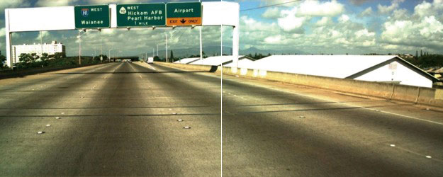
Since 2003 they have been continuously improving the resolution of these images through the use of more and better cameras. In 2003 they were using two 1280 x 1024 pixels cameras; in 2006 two 1600 x 1200 pixels cameras; in 2007 three cameras each having the aforementioned number of pixels; in 2009 three 2048 x 1152 pixels cameras; and in 2011 three 3296 x 2472 pixels cameras.
Increasing the resolution of their photo-log images enabled Hawaii DOT
to record the most minuscule details such as strains on gantry signs as
well as increasing the recordable range of each image.
 |
 |
| Image from 2003 | |
 |
|
| Image from 2003 | |
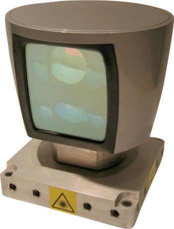
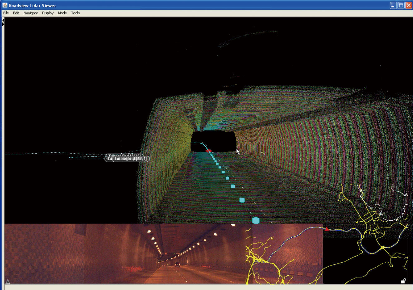
In 2009 Hawaii DOT began using the Mandli's LiDAR (Light Detection and
Ranging) data collection system. A mobile 3D laser scanner capable of measuring
road surfaces and roadway assets to an accuracy of 2cm.
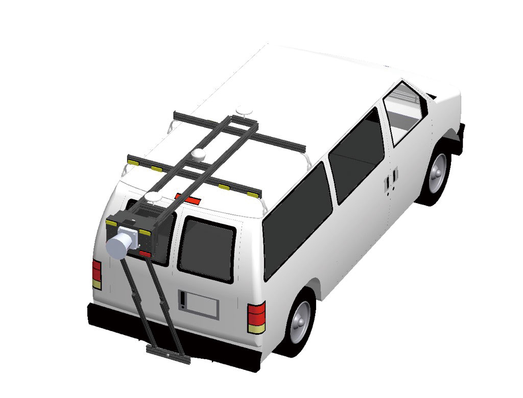
The vehicle on which digital cameras and the LiDAR system are mounted can record both photo-log images and point cloud data of the target area simultaneously in a single pass.
 |
 |
|
| The LiDAR data collection system | ||
The LiDAR laser scanner / digital camera system was used in 2009 to measure and record 1,000 miles of roads throughout the island of Oahu. The point cloud data collected was huge, consisting of 200 billion points with a collective size of 630GB. Hawaii DOT chose to save this data in the "Mandli format", the reason being its ability to store entire road linear data into a single set of files. In 2011, they initiated a similar survey point to record roads on the Island of Hawaii.
One of the major features of Hawaii DOT's 3D LiDAR dataset is the ability to perform measurements on both point and linear road features.
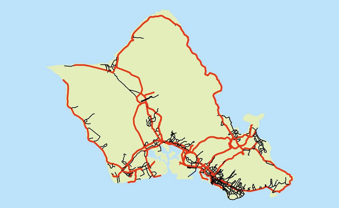 |
| The target area for the 2009 survey of 1,000 miles of roads throughout the island of Oahu |
 |
 |
|
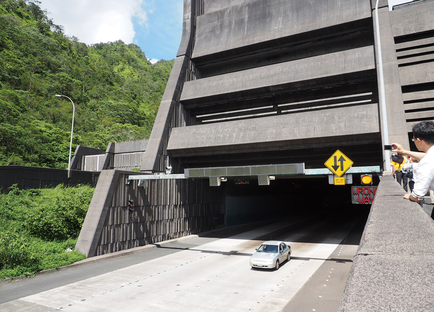
| Entrance to the Tetsuo Hara H-3 tunnel | Point cloud data inside the tunnel |
| The objective of the Hawaii DOT integrated road information systemad information system |
The primary objective of the development of an integrated road information system is to facilitate the management and maintenance of roadside assets and facilities throughout the state. The aim is to manage the information of state facilities and assets through their whole life cycle. In addition, the system is designed to achieve zero information leakage, to enable the information to be accessed from anywhere within the DOT, to share information that has been seen and/or heard and to integrate all this information within a state wide GIS (Geographic Information System).
One of the characteristics of GIS is its ability to hold a variety of different types of information in one place. For example; DRG/Aerial photographs, information concerning asset lifetimes and utilities, information regarding road facilities, land use and land cover data as well as environmental data. All this data can be stored and viewed together as one large dataset.
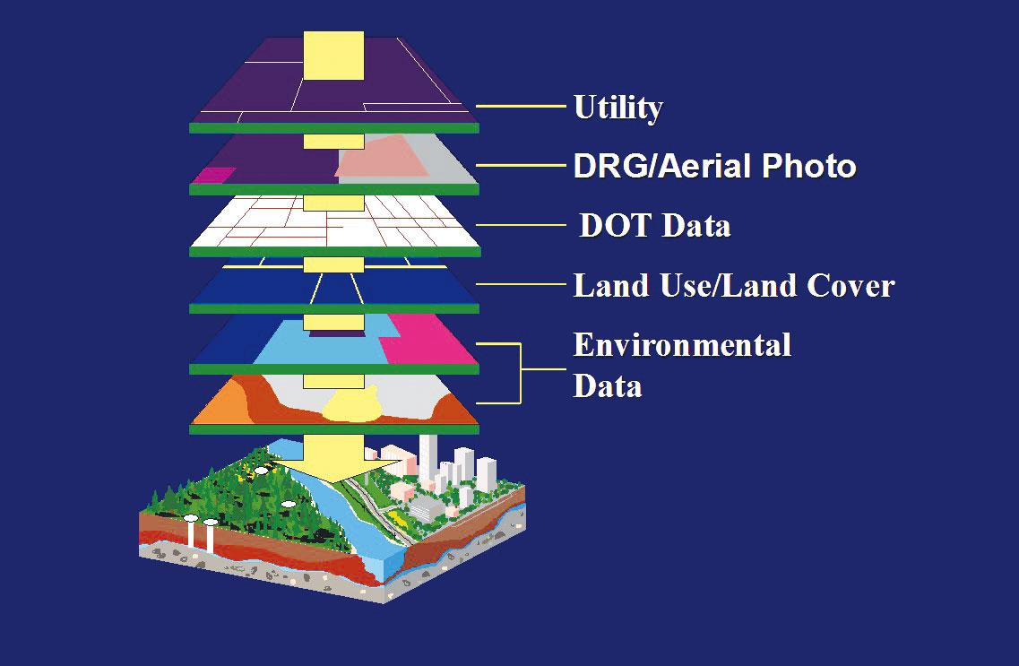 |
| A conceptual diagram of GIS which shows various types of information integrated into one data set |
| The use of the FORUM8 point cloud PPE within VR-Design Studio (UC-win/Road) |
 |
 |
|
| A composite image of the point cloud data and the measurement and positioning of the colored pixels from the photographic data |
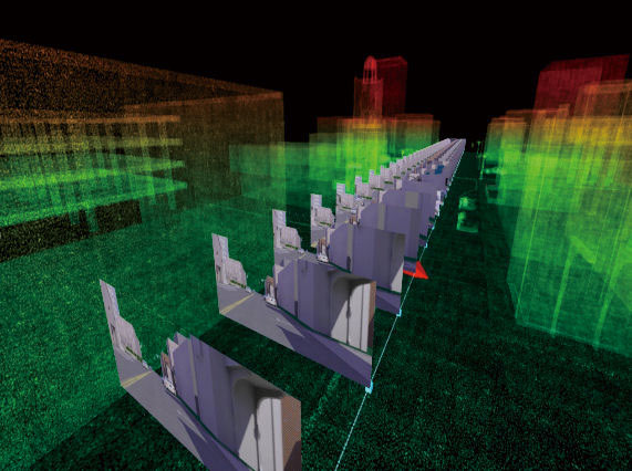
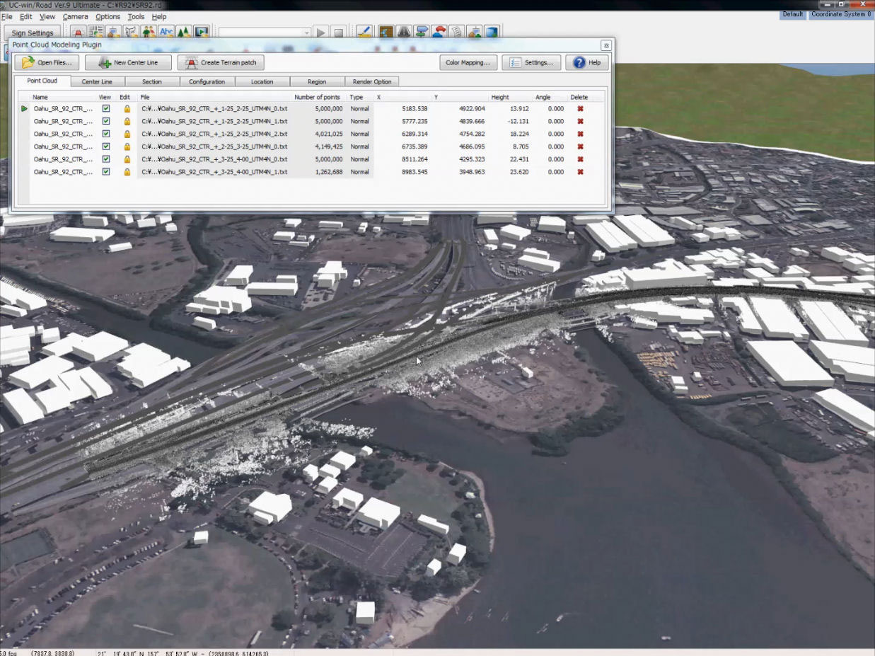
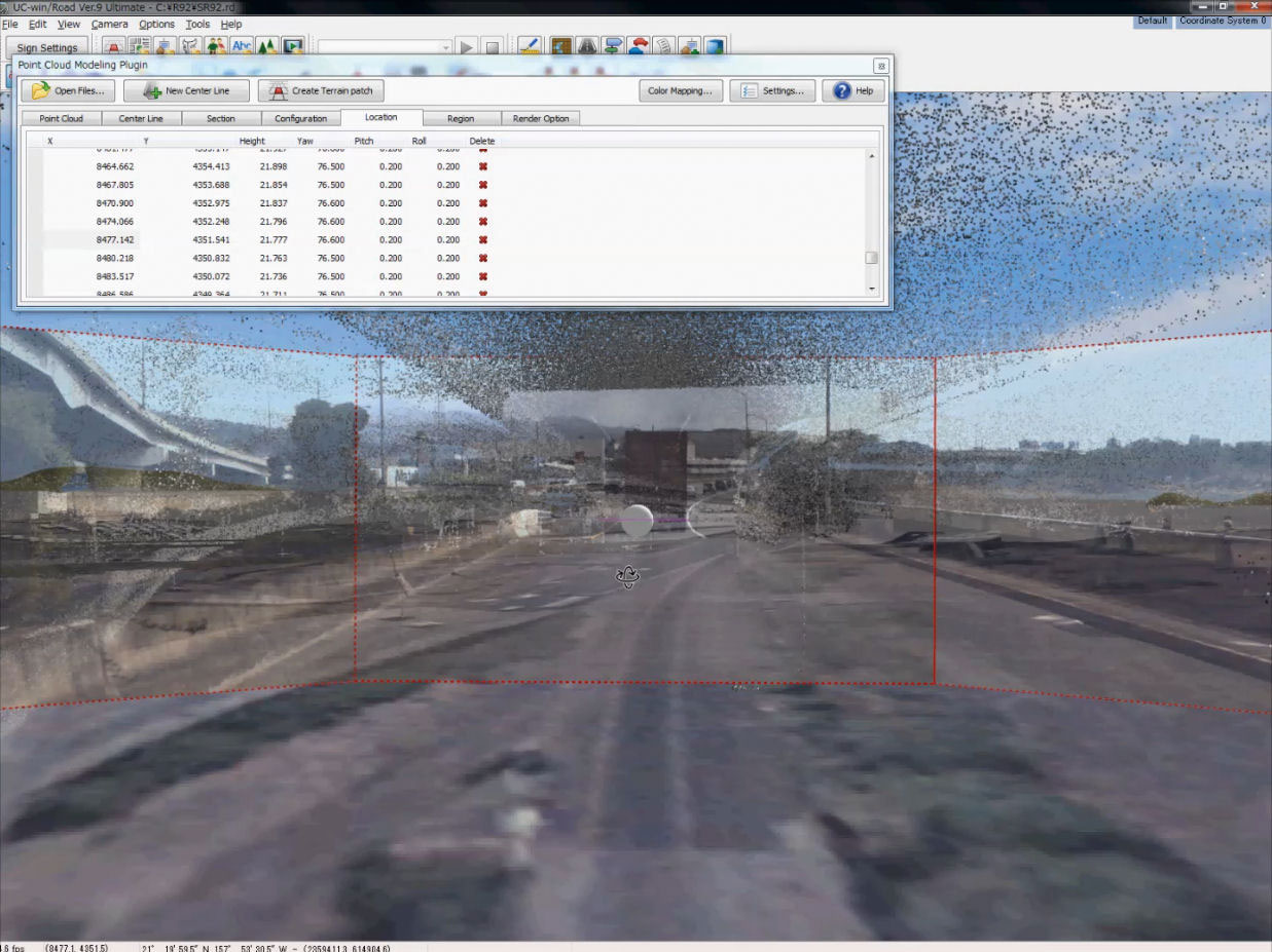
Loading the point cloud and photographic data into VR-Design Studio (UC-win/Road) |
|
 |
 |
|
| Combining the position of the photographic data and point cloud data |
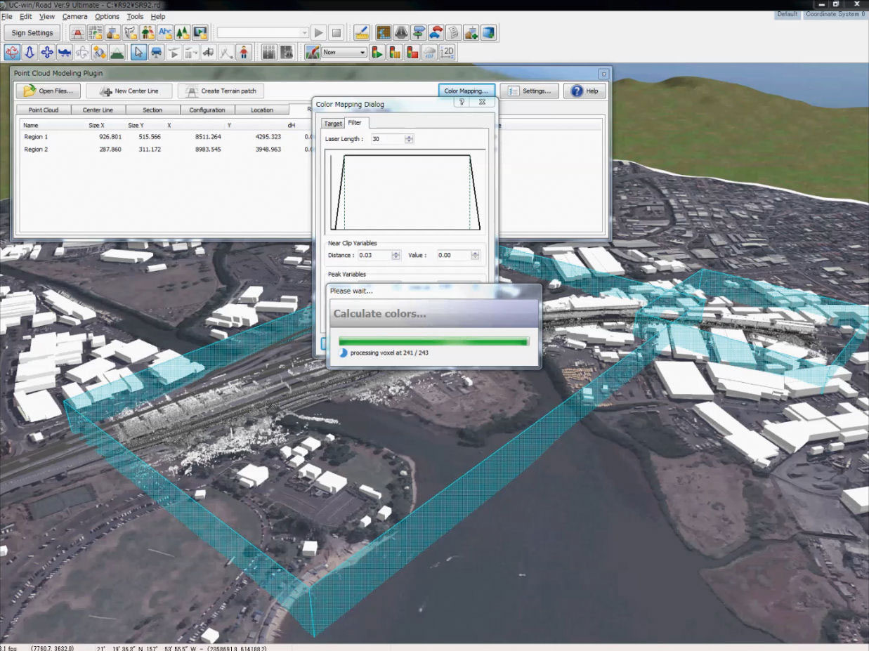
The calculation process of coloring the point cloud data |
|
 |
 |
|
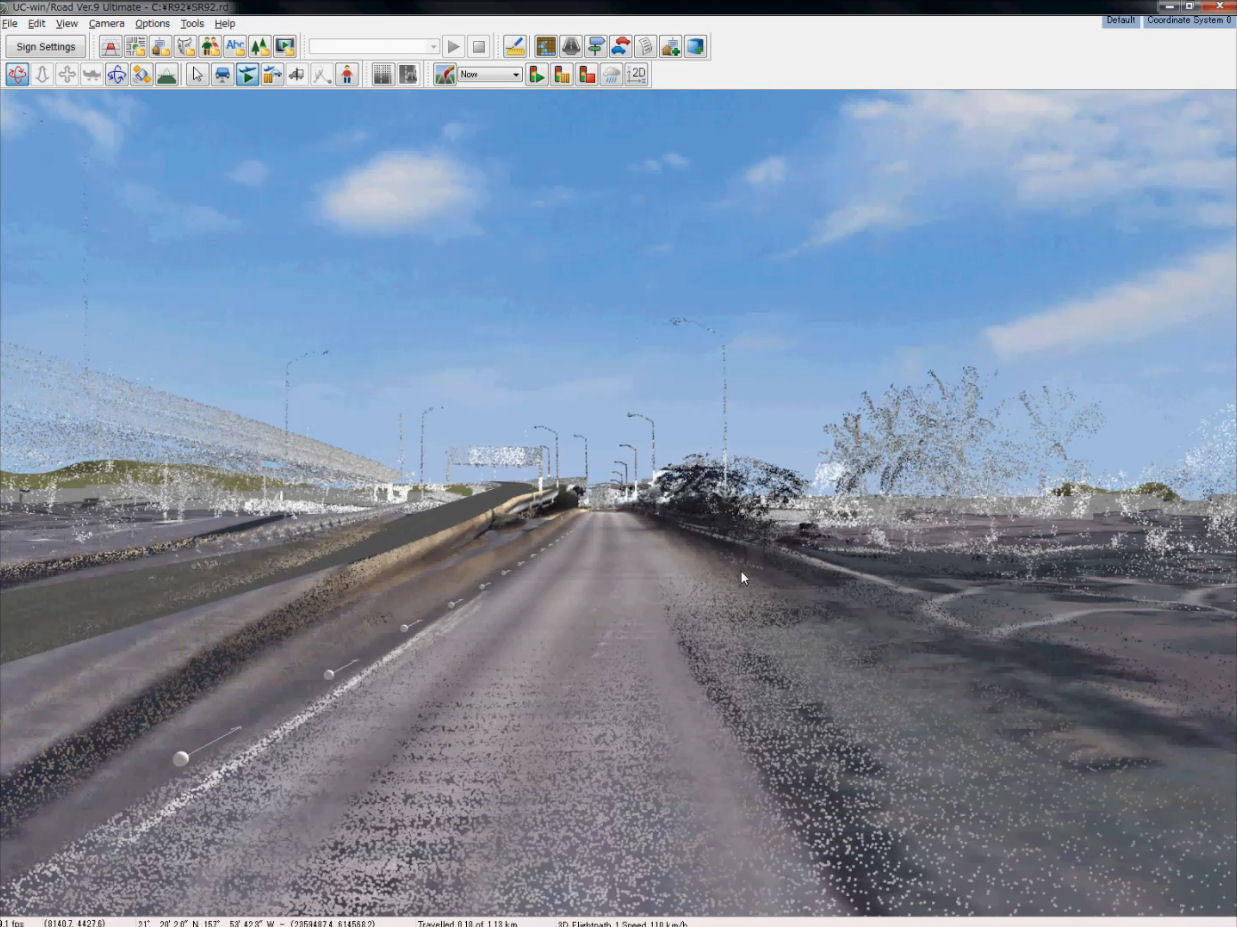
| Driving simulation inside the colored point cloud data |
Goro Sulijoadikusumo (Right side) and colleague |

