 |
Vol.1 2010. 11. |
The latest news of 3D drawing service / 3D modeling service / 3D scan VR modeling service
BIM&VR solution catalogue /Student BIM Contest
FORUM8 launched 3D scan service of building and road using 3D laser scanner. The scanned data is imported as the point cloud models using the point cloud modeling plugin of UC-win/Road Ver.5, for accurate representation of the shape of buildings and bridges in VR.
FORUM8 is currently involved in a joint research project of point cloud measurement with Prof. Yamazaki, Tokyo University of Agriculture and Prof. Kawamura, Kitami Institute of Technology. The intersection in Shibuya and the street located in the heart of Nihombashi were measured in September, 2010.
The digital camera system with 3D measuring device and wide-angle lens is mounted on SUV.
The laser is irradiated when the vehicle stops at the road berm and 4,500,000 of point cloud can be measured in ten minutes. Once the measurement at a survey point is completed, the vehicle is moved and measured again at a different survey point. This is called the "Stop and go method". This method allows the efficient measurement of the long road. For the ranges which cannot be measured due to them located in blind areas from the survey point, superimposing multiple data can be done.
The range of measurement is 360 degree in a horizontal direction and 80 degree (50-130 degree) in a vertical direction. The picture from the survey point is automatically taken by the digital camera on the vehicle at the same time as the measurement of point cloud. After that, this image is calibrated and merged as the point cloud with color information.
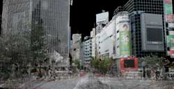
The image 1 is the display of Nihombashi center street which is measured in 6 points and converted into UC-win/Road using point cloud modeling plugin. The road geometry, vehicle lane, marking, and letters in traffic signs are measured in the recognized level. Image 2 shows the display of the intersection in Shibuya which is measured in three points and superimposed in the special software. It is measured in the early in the morning with few pedestrians. The blind area from the survey point is complemented by the data from other survey point.
 |
 |
|
The linkage with RoboCar(R) is under development as it is proposed tobe an advanced application of point cloud modeling.
RoboCar(R) is the car robotics platform scaled model car developed by ZMP Inc. It allows the detection of obstruction, algorithm of vehicle recognition and wireless communication with each sensor can be performed using its full-scale drive system, stereo camera, rapid image recognition module, and stereo view.
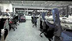
FORUM8 uses the 3D laser scanner of Nikon-Trimble Co., Ltd. Image 3 shows FORUM8 Tokyo head office in Nakameguro GT tower 15F which is measured using this technology.
 |
It is used for VR space where RoboCar(R) is running. The coordinate of RoboCar(R) is acquired and the simulation in multiple reality is performed. We have developed it with a perspective of VR application in robotics industry to be expected in various sectors such as service robot.
FORUM8 has BIM&VR solutions based on BIM integrated software "Allplan" and 3D VR software "UC-win/Road" as a new business model in civil engineering field.
The Brochure of "BIM&VR" which shows the linkage image of the integrated solutions with BIM and the future expansion is prepared.
 |
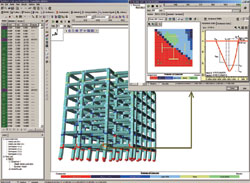
Allplan allows the data conversion of a variety type of 2D/3D file format including IFC of 3D building model data which is standardized by IAI as indicated in the above image of "The linkage image and future expansion of BIM integrated solution" excerpted from the Brochure. In addition, the data exported in 3DS format can be linked with FORUM8 products such as UC-win/Road.
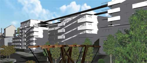
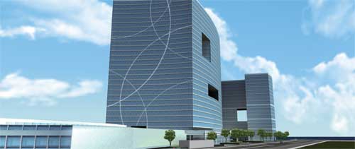
There are some case studies for using BIM architecture/civil design solution; Build Live Tokyo 2009 II and Build Live London 2009 (BIM 3D architectural modeling competition). See the following images excerpted from the Brochure. Team F8W16 joined in Build Live Tokyo 2010 held in October 13-15, 2010. For details, please see the report posted on Up&Coming vol.88(Build Live Tokyo 2010 Report).
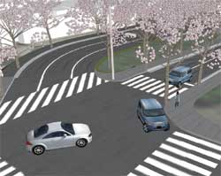
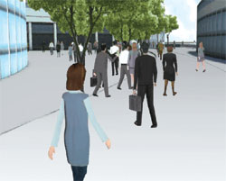
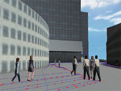
| Build London Live 2009 The terrain and traffic network of the imaginary island were created with UC-win/Road to generate the traffic stream. The crowd simulation was performed through the linkage with EXODUS.
|
||||||||||||||||
FORUM8 will hold the 1st Student BIM&VR Design Contest in 2011. The main theme is BIM&VR and the works which are designed using more than two of FORUM8 software solutions by students can be applied to this contest. It is anticipated that the new use and ideas of BIM&VR would arise through this contest.
| Application of the 1st Student BIM &VR Design Contest | |||
| : | September 1st 2011 - October 31st [due NLT] | ||
| : | All students (including adults). Project work which is created before graduation in 2011 as a graduation assignment will be eligible. |
||
| : | 1.Architecture design 2.Bridge design |
||
| : | Please submit your work after registration. The detailed information will be announced later. | ||
| : | Grand Prix, excellent award, entertainment award, encouragement award,
honorable judge award are decided for each section. Grand Prix: Certificate, trophy, extra prize:500,000 yen of scholarship(for each section) Prize:Notebook computer, digital camera, printer (provisional) |
||
