 UC-win/Road UC-win/Road Support System UC-win/Road UC-win/Road Support System
|
 |
|
|
 |
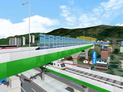
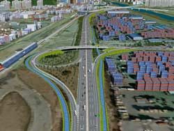
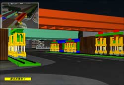
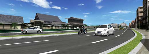
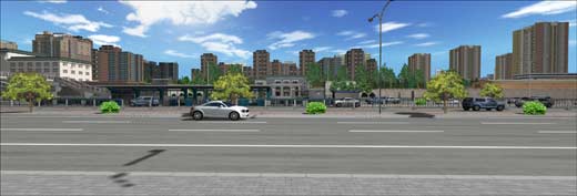
| VR Data for Ohashi Junction of Metropolitan
Expressway |
|
|
| Metropolitan
Expressway Company Limited |
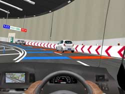
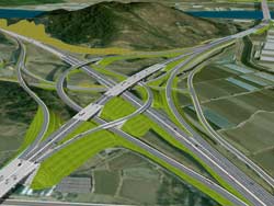
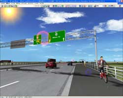
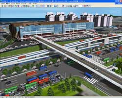
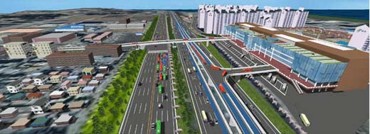
The Metropolitan Expressway Co., Ltd. is
conducting an experiment with driving simulator. The experiment is to
ensure effectiveness in traffic safety at Ohashi Junction, which
connects Shinjuku Central Circular Route(under construction), Shinagawa
Central Circular Route and Route No.3 Shibuya Line. In this experiment
UC-win/Road driving simulator is actively used.
|
 |
 |
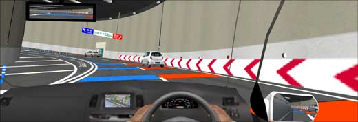
 VR Data of Ohashi Junction used for traffic safety and
effectiveness VR Data of Ohashi Junction used for traffic safety and
effectiveness |
Overcrossing 4 rods in limited space |
 |
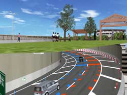 |
| Ensuring the effectiveness in traffic safety at Ohashi
Junction, |
Double loop line to connect roads with 70m height difference |
 |
| Rooftop of the junction is going to be used as a planted
park |
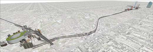 |
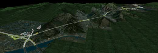
| Planned as the second longest tunnel in the world |
 |
| Tunnel between Shinjuku Central Circular Route and
Shinagawa Central Circular Route |
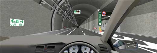 |
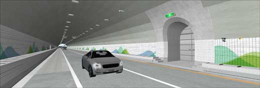
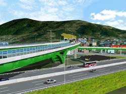
| Examining the best position for the road signs |
 |
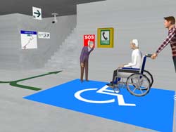 |
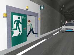
| Will be used to explain and display the evacuation route |
Examining the optimization of evacuation guiding signs |
|
|
|
 |
| VR simulation of Design Change of Korea Namhae
Highway |
|
|
| Korea
Road Agency (Korea) |
UC-win/Road was used for consensus building with
the local residents at Korea Namhae Highway, which is under
construction.
There are two plans, initial plan and the current one, and include
objections from local residents. Various kinds of simulation were done,
including simulation of influence to local residents by the distance
from the road. The data was used as discussion material for the
consensus with residents and related agencies.
|
 |
 |
| DAEDONG JCT |
Revised plan due to LRT construction plan |
 |
| Namhae Highway between Naengjeong
and Pusan |
 |
| Tunnel used for evacuation |
 |
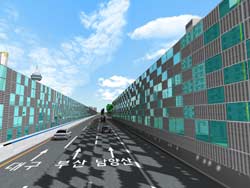 |
| Aiming to ease the traffic congestion |
Noise barrier (over 10m high) |
 |
 |
| Canal from freight yard to sewage (treatment) plant |
The data was used effectively as discussion material for
the consensus with residents and related agencies. |
|
|
|
 |
| Simulation of Railway Bridge Beam Construction Work |
|
|
| Noda
Engineering Co., Ltd. |
To increase the carrying capacity of the railway,
replaced a railway bridge for double track railway. The installation
work must be finished at midnight and should be done with minimum
impact on the road below the railway. Speedy and economical method was
being investigated and the construction simulation was done with VR.
|
 |
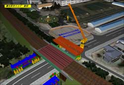 |
| Simulation of Railway Bridge Beam Construction Work |
Removed beam is hanged by crane and crane rotates |
 |
| Modeled surroundings including temporary stockyard |
 |
 |
| Old beam is removed by sliding jack |
The installation work must be finished at midnight |
|
|
|
 |
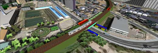
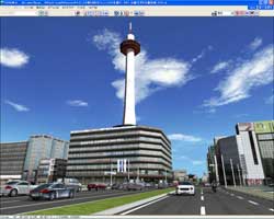
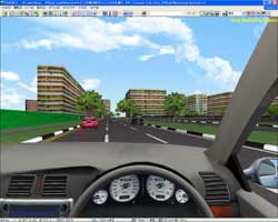
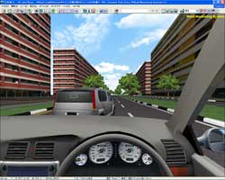
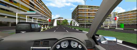
| Simulation of Traffic in Kyoto City |
|
|
| Graduate
School of Informatics Kyoto University |
Driving data is collected to make a simulation
model which reproduces human driving behavior in Kyoto City, built on
UC-win/Road Driving Simulator. To acquire realistic driving data, we
have elaborated in creating the data which has the sufficent quality to
give drivers the feeling of driving real Kyoto streets. With this
environment, we are planning an experiment by using examinees to
collect large amount of data.
|
 |
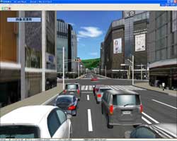 |
| Simulation of Traffic in Kyoto City |
Reproduces the traffic condition in Shijo Kawaramachi, the
busiest area |
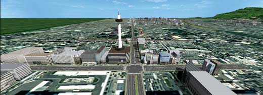 |
| Aim is to collect data to build
human driving behavior model |
 |
| Modeling of the route from the Kyoto
Station to Kyoto University |
 |
| Modeling of traditional buildings
and streets of Kyoto |
|
|
|
 |
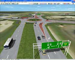
| VR Data of Roundabouts in US 41 Project |
|
|
| Ourston
Roundabout Engineering, Inc.(USA) |
The Wisconsin Department of Transportation
(WisDOT) plans to reconstruct and expand US 41. This work is made by
Ourston, which was asked by WisDOT, to teach WisDOT and to educate
people in the correct driving operation when it comes to roundabouts,
by using driving simulator.
|
 |
 |
| VR Data of Roundabouts in US 41 Project |
This work was made to educate people on the correct way to
negotiate roundabouts. |
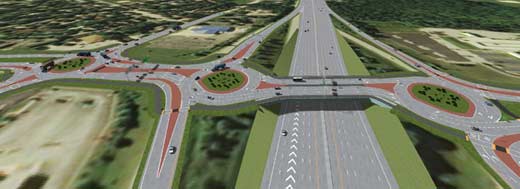 |
| Appearance of the 3 adjacent roundabouts |
 |
| The Wisconsin Department of
Transportation plans to construct 44 roundabouts in US41. |
 |
 |
| Roundabouts produce efficient traffic flow. |
The important thing is to educate the drivers. |
|
|
|
 |
Regional Construction Award
Mr. Hiroo Kasagi, NPO Chiiki Zukuri Kobou |
|
| Proposal of Reproducing Environmentally-friendly
Waterland City Hino |
|
|
| Hosei
University |
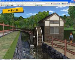
In Hino City, which was once one of the largest
farm areas in Tokyo, a water channel network for irrigation was
developed in the Tama River and Asakawa area. The city of Hino, in
response to the rapid increase in population from 1960's actively
redeveloped land and now 50% of the city is designated as redeveloped.
In these areas many of the water channels were lost. Total length of
the canal was 218km, 177km in 1977, and it is now said that only 130km
remain.In 1995, the area was designated as "Town of Water" by then
Ministry of Land, however, the rural landscape is certainly gone, the
number of channels has decreased. Therefore we are proposing a new type
of land redevelopment utilizing the water-rich environment around the
channels of Hino City.
|
 |
 |
| Environmentally-friendly land readjustment plan of
Waterland City Hino |
Electric power generation by the use of small water channel |
 |
| Apartment area, separate house area
and plantation area |
 |
| Small scale part-time farmers to
produce foods for local consumers |
|
|
|
|
Design Award
Mr. Fumio Seki, Taisei Engineering Co., Ltd |
|
| VR Project of Beijing Guomian Group (Jingmian
Second Factory) |
|
|
| Beijing
Water Cube Digital Technology Co.,Ltd. (China) |
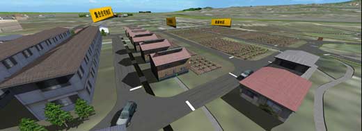
Guomian Group is located to the east of Beijing
CBD, overlooking from its main gate, the landmark buildings, such as
CCTV, China International Trade Center and Huamao. In the 1950s,
designers of the former Soviet Union designed and the construction has
begun. Interior decoration reflects those days style. With UC-win/Road,
showing in VR the old plant of the Guomian second plant and the new
plant, which will be relocated in near future and change to Cultural
and Creative Industrial Park in VR.
|
 |
 |
| Beijing Guomian Group Jingmian 2nd Factory- office room and
an old made-in- China fan |
Appearance of Jingmian second plant |
 |
| Building front and its surroundings-
the plant will change to Cultural and Creative Industrial Park. |
 |
 |
| Try to record the old plant by VR as a conserving material |
Arbors for the rest can also be seen by VR |
|
|
|
|
Artistic Award
Mr. Sinsuke Kitagawa, Yachiyo Engineering
Co., Ltd. |
|
| Creation of Road Which Is Suitable for Aso Kuju
National Park |
|
|
| Nishitetsu
C.E.Consultant Co.,Ltd |
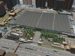
This VR data shows planned four-lane road of
national highway that passes through the Aso Kuju National Park (Scenic
Byways).
Construction of this route must be done in order to cause minimum
impact on the railway alongside of the road, in addition to caring for
the steep terrain. So not only the driving simulation environment
(internal), but also the influence on the surrounding area must be
considered. With VR data, proposed the landscape examination and the
ease of traffic congestion.
|
 |
 |
| 1-Aiming to create a road which is suitable for the Aso
Kuju National Park |
Planned model of 4-lane "Scenic Byway" |
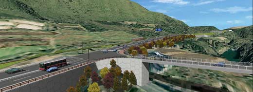 |
| Aiming to ease traffic congestion and preserve natural
landscape |
 |
| Modeling of Aso Kuju National Park
and surrounding landscape |
 |
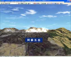 |
| Expression of the coloured leaves in autumn |
Five mountains (Aso Gotake) which makes Mt. Aso |
|
|
|
 |
|
|
| Temasek
Polytechnic (Singapore) |
The road monitoring system is a system that acts
as a virtual driving simulator to assist drivers in rehabilitation and
assessment. Therefore the simulator will be able to test the users
physical condition and problem solving skills in order to rate their
condition.
|
 |
 |
| Road monitoring system |
Training simulator for physical rehabilitation for stroke
patients |
 |
 |
| Signal settings and avoiding obstacles |
Physical balance check for the drivers |
 |
| Proposal of a rehabilitation
supporting system |
|
|
|
|
| Transfer VR simulation at Junjon Service Area in
Korea |
|
|
| GTSM
Inc. (Korea) |
VR simulation by using UC-win/Road was conducted
for Junjon Service Area, which is managed by Seoul Regional Land
Management Office. To ease traffic jams on the roads to the
neighbouring cities, the simulation by UC-win/Road was used to support
decision making of 3 plans including creation of bus-lane and rotary
intersection.
|
 |
 |
| VR simulation for transfer at Junjon Service Area |
Plan to construct a bridge at the intersection |
 |
 |
| The 2nd plan: Highway bus lane separated from city bus lane |
The 3rd plan: Making rotary |
 |
| VR accelerated the decision making
of the project |
|
|
|
|
| VR Simulation of Pedestrian Behavior at Pedestrian
Bridge Construction |
|
|
| Shanghai
Chikushi Construction Design Co., Ltd. (China) |
VR model shows the pedestrian behavior and flow
at the time of renovation and construction of a pedestrian bridge in
the United Kingdom (about 150m). Results of the data from the crowd
analysis software have been linked to UC-win/Road, and the intuitive
presentation has become possible. The data was used for reproducing the
planned completed construction and for further safety as well as
simulating the pedestrian flow.
|
 |
|
 |
| VR Simulation of Pedestrian Behavior |
|
Results of the data from the crowd analysis software have
been linked to Micro Simulation Player |
 |
|
 |
| Result of the regulated Pedestrian flow |
|
Pedestrian flow on the shopping streets |
|
|
|