 Program Overview Program Overview
- We introduce GeoFEAS 3D Ver2.0. This program performs 3D geotechnical finite element elastoplastic analysis of the terrain data based on finite element method(FEM). It allows 3D analysis based on real geometry by modeling the site terrain in 3D including pier foundation issue, .the effect on surrounding terrain by tunnel excavation, slope stability analysis.
In Ver.2, model creation feature is largely enhanced by some improved functions; modeling the intersected model, importing the data on terrain surface from Land XML, semi-auto mesh function based on tetrahedron by inputting division number.
In addition, the speed and volume of the analysis parts are improved, the freedom degree is together with 3D model. Herewith, the arrangement of pile foundation which was analyzed in 2D before is expressed sterically, and the analysis of the model to be located in complex terrain layer, and the sterical model such as tunnel/tunnel or tunnel/pier can be performed. The realistic slope stability analysis can be also available by expressing landslide terrain in 3D.
 Significant improvement of model creation function Significant improvement of model creation function
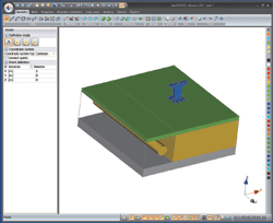
- The lower left image shows the analysis case example of tunnel and pile foundation of bridge pier.When the pile is expressed using finite element analysis, the round shape and pile arrangement cannot be expressed correctly in 2D. In addition, 3D analysis is essentially required to analyze in the tunnel-boring progress along each construction stage including tunnel-boring and lining when you want to assess the effect in pile foundation.
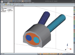
In the urban area, many of civil engineering structures are crossed sterically(See
the image right below), and it allows the expression of more realistic
terrain, the geological conditions, and the structure association by modeling
in 3D.The mesh creation function is also improved so that user can create
the selected mesh including tetrahedron easily.
 |
|
 |
 Tunnel and bridge pier Tunnel and bridge pier |
|
 Tunnel intersect model Tunnel intersect model |
 Importing of terrain surface data in LandXML format Importing of terrain surface data in LandXML format
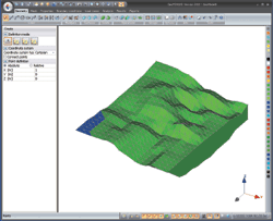
- The coordinate and elevation data of terrain surface and layer boundary created in terrain data file format, LandXML now can be imported(See the image left below). This function allows automatic construction without inputting complex terrain information manually.
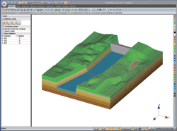
The structure object can be modeled based on the terrain information(See the image right below). The same terrain information can be shared via our landscaping simulation software UC-win/Road and files. The finite element analysis of deformation and stability is
judged by GeoFEAS3D ergonomically. The reason the objects which is analyzed
by GeoFEAS3D are simulated in the site terrain is that UC-win/Road allows
the visualization of the new building or the terrain which may be occurred
the slope failure based on the real terrain.
 |
|
 |
 LandXML data importing LandXML data importing |
|
 Terrain data and structure Terrain data and structure |
 Elastoplastic analysis function Elastoplastic analysis function
- The stability analysis can be performed by using a number of soil structure models and shear force reduction method(See the image below) as the existing elastoplastic analysis function.
The shear force reduction technique is the method for detecting where large shear strain increases in the place equivalent to shear surface by setting the soil to elastoplastic model, and repeating the calculation with incremental safety ratio to strength parameter. This method allows the detection of the stability surface, not only circular arc or straight line, based on real terrain layer and terrain condition in arbitrary terrain.
In addition, it is reported that the results of safety ratio is equivalent to normal arc stability method(Bishop method).
It can be applied to 3D slope stability analysis of the landslide terrain and steep terrain.
The program has the function available for considering countermeasure construction
as the modeling function of structure in beam elements.
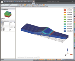 |
 Analysis result with shear force reduction method Analysis result with shear force reduction method |
 Considering complex soil structure model parameter Considering complex soil structure model parameter
- In general, the geotechnical analysis is required modeling the ground deformation behavior precisely, inputting the detailed data, and judging based on the advanced technique. The linear elastoplastic model(the simplest), Mohr-Coulomb's model(traditional), elastoplastic model(general), PZ-Sand(Pastor- Zienkiewicz) are prepared.
"Element test simulation program" that accompanies our geotechnical analysis series GeoFEAS2D, UWLC starts to be included in Version2. When many parameters such as PZ-sand need to be decided, you can consider the soil structure model in detail many times by element test simulation(See the image below).
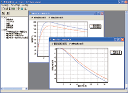 |
 Element test simulation Element test simulation |
 Finally... Finally...
- This update allows the creation of complex terrain and structure model
easily. We will strengthen the support service that 3D FEM analysis can
be used by more people as a general method.
|


 Tunnel and bridge pier
 Tunnel intersect model

 LandXML data importing
 Terrain data and structure
 Analysis result with shear force reduction method
 Element test simulation