
This is the universal plug-in which enables to reproduce and visualize the various
simulation results, of such as tsunami analysis code developed by university and
research institution and even of commercial-release tsunami analysis program.
Program Overview
This is the universal plug-in of UC-win/Road which enables to reproduce and visualize the various simulation results, of such as tsunami analysis code developed by university and research institution and even of commercial-release tsunami analysis program.
- FORUM8's original open format is implementable. Data of any form can be visualized by converting the format.
>> UC-win/Road Tsunami Plugin file format information - The ability to visualize flood propagation by importing the terrain mesh data used for analysis and the ability to create the terrain patch from this mesh.
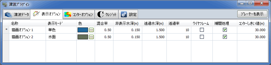
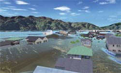
- Colour contour or reflection of water surface can be selected as means of visualization.
- Results of a large scale analysis can now be applied. Simulation in long stretches is possible by reducing the memory consumption at the time of performing an animation.
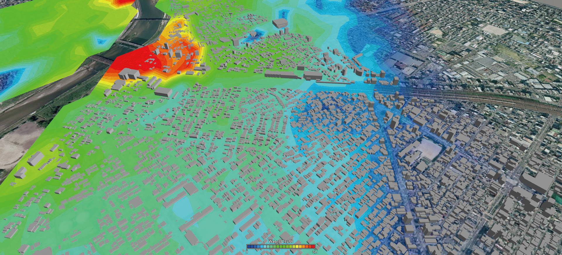
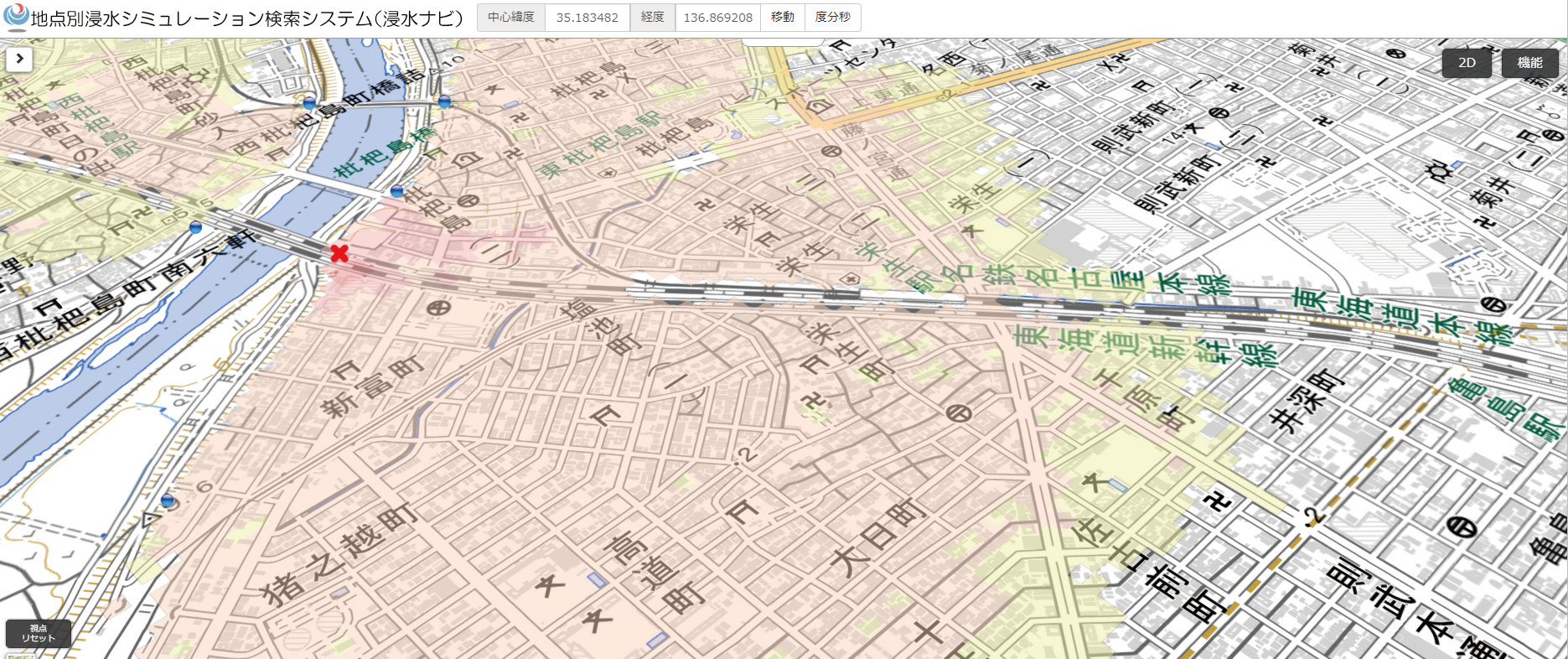
- Flood Navi Data can be imported. NEW!
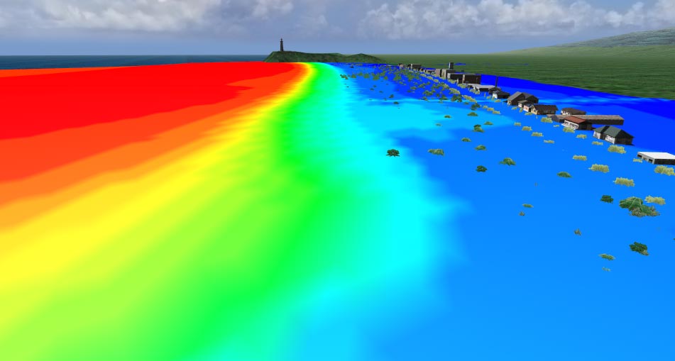
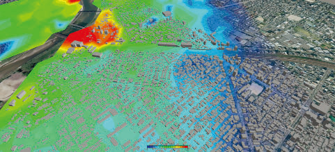
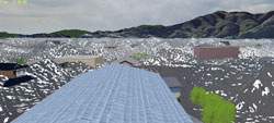
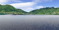
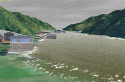
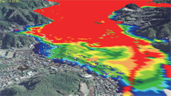
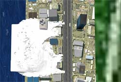
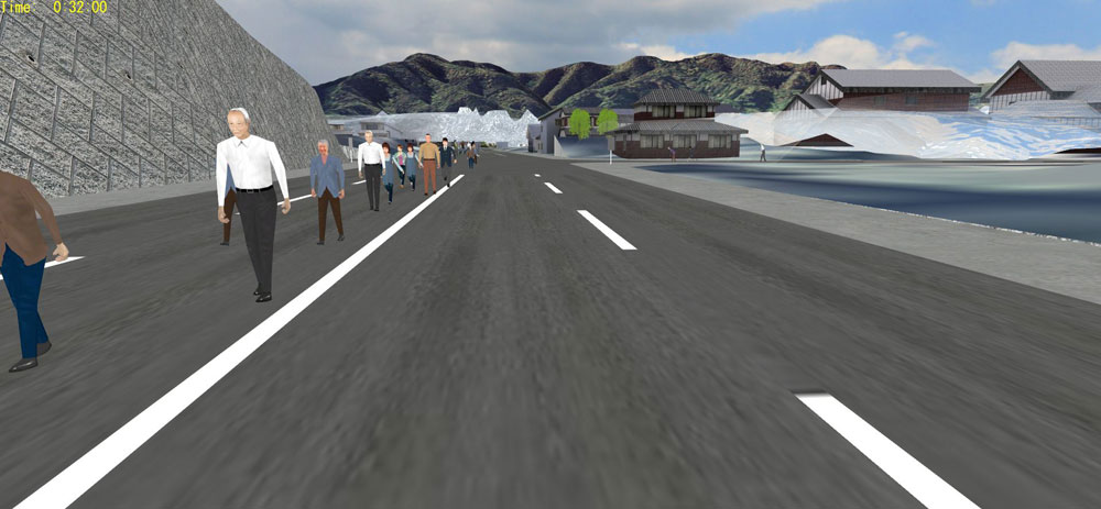
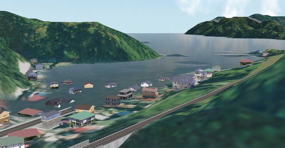
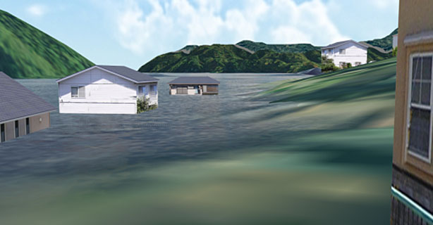
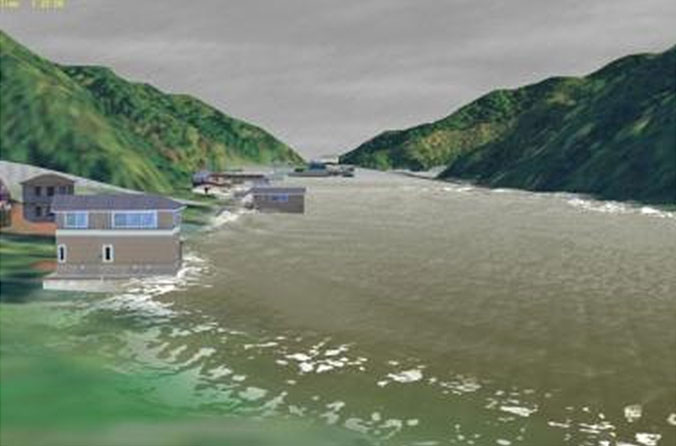
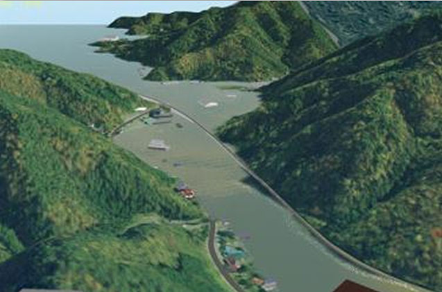
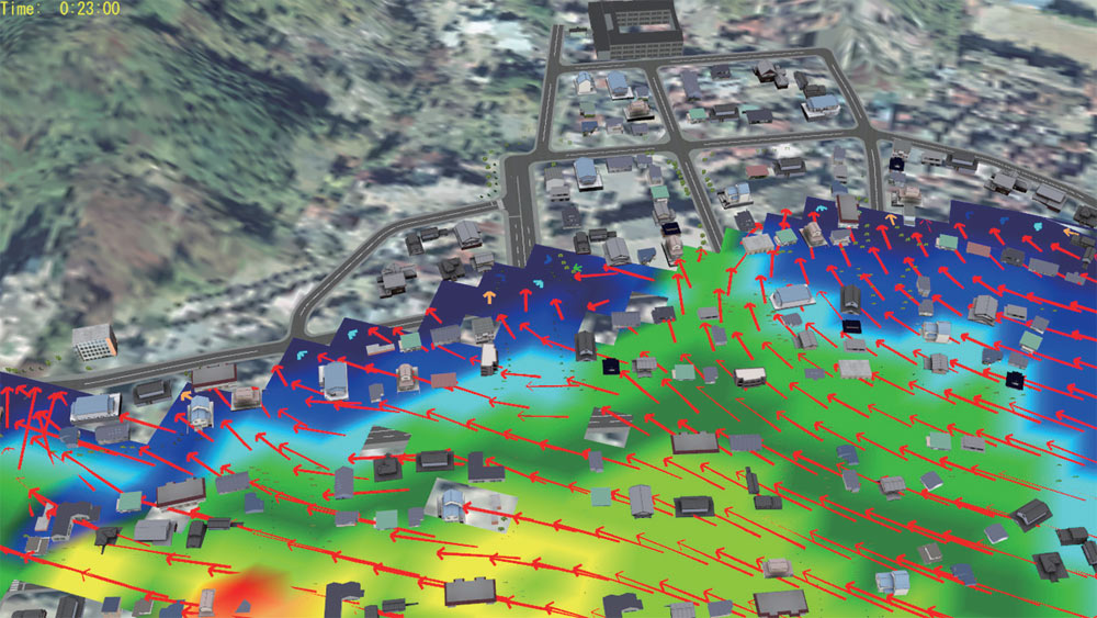
▲Contour expression based on flood depth
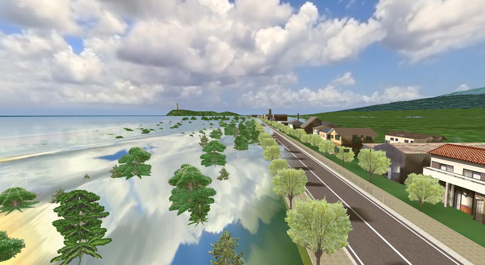
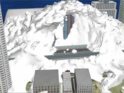
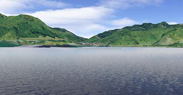
▲Expression of water surface reflection
Related Information
Functions and Features
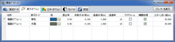
Import Tsunami data
-
- Tsunami plug-in standard format
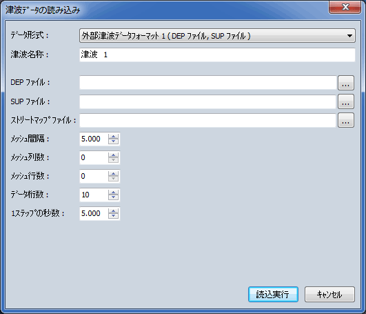
- External tsunami data format 1 (DEP file, SUP file)
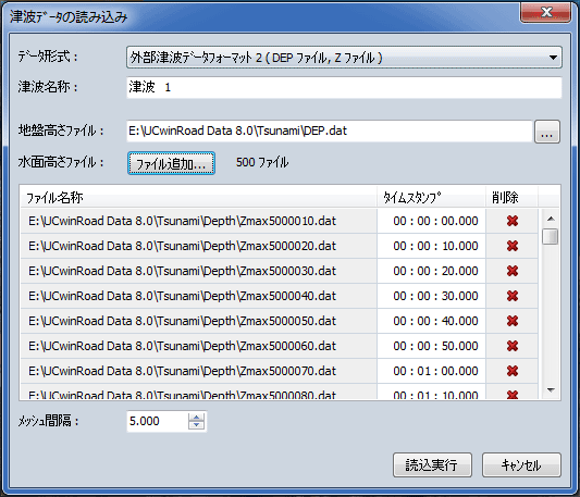
- External tsunami data format 2 (DEP file, Z file)

▲Importing external tsunami data format 1
(DEP file, SUP file)
▲Importing external tsunami data format 2
(DEP file, Z file)
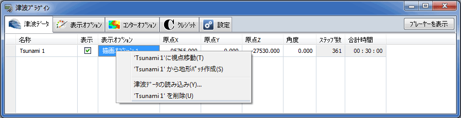
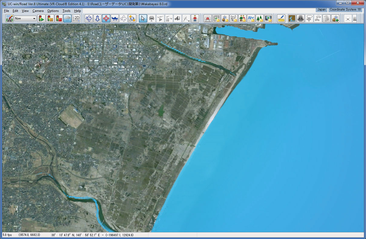
Creating the terrain patch from tsunami plug-in
-

▲Screen for inputting tsunami data
▲Screen for inputting drawing option

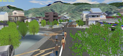
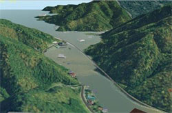
▲Terrain and water surface
from the top view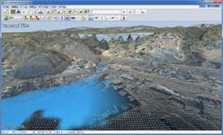
▲Drawing setting : Wire frame

Flood Navi Data Import NEW!
-
The Tsunami Plug-in has a function to download inundation data from the Flood Navi system of the Ministry of Land, Infrastructure, Transport and Tourism, enabling visual simulations of inundation using the data on UC-win/Road. Once the data has been imported, it is possible to check water level changes over time and visualize gradients to create a realistic representation of the water surface by using the Tsunami Plug-in function.
Simulation on UC-win/Road using Flood Navi data
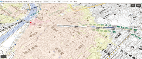
Animation on the MLIT's Flood Navi
UC-win/Road Tsunami Plug-in file format information (posted on '13.02.19)
-
Tsunami plug-in is a plug-in of UC-win/Road that imports tsunami analysis result to UC-win/Road for visualization.
Different analysis software exports analysis result to a different format, which means analysis results from around the world come in various file formats. A standard file format has been established to realize the import of tsunami analysis result in various different file formats to UC-win/Road instead of making the Tsunami plug-in deal with all those different file formats out there. The establishment is indeed a revolution as data can now be exchanged smoothly and seamlessly between UC-win/Road and the 3rd party analysis program.
A detailed specification of the standard file format has been released allowing our valued users to convert their data in accordance to their working environment.
More developments are coming your way including the ability to visualize flow velocity and wave power. Our plan is to expand the standard file format by taking into account the kind of interoperability that can come in handy in every possible situation, in order to provide even more flexible interaction between our 3D Visual Interactive Simulation and Modeling software and the 3rd party analysis program.
Related Products and Services
-

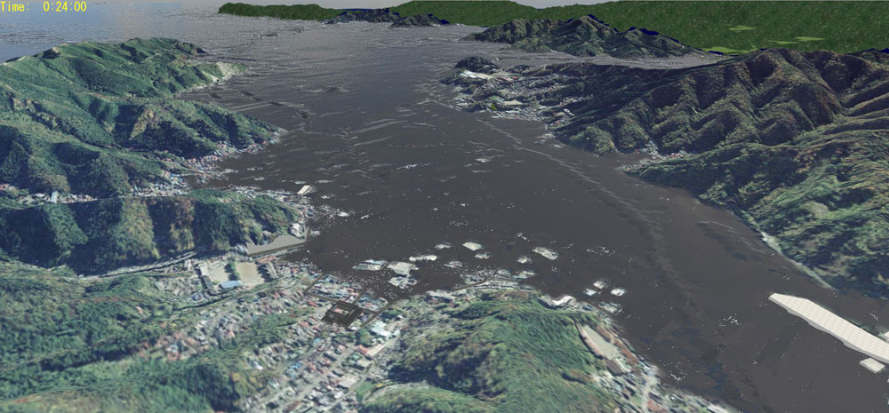
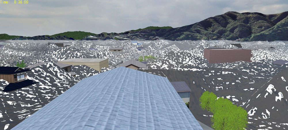
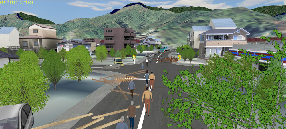
UC-win/Road xpswmm plugin (for Tsunami)Tsunami analysis based on the difference method of the shallow water equation
The plug-in is known for its feature that enables 3D VR software UC-win/Road to visualize tsunami propagation in a very realistic manner.
Tsunami can be generated via xpswmm linkage; and tsunami position, range, and height can all be assigned on the Visual Options window.
The inundation zone and inundation height is predicted based on the difference method of the shallow water equation. Furthermore, the plug-in can evaluate the wave power imposed on houses and buildings and calculate flotsam/ jetsam/ driftwood/debris transport as well as the wave height and velocity at each mesh point and then draw a wave height distribution map. The model that relate to the research conducted at the Tohoku University Tsunami Engineering Laboratory (run by Professor Fumihiko Imamura) is proposed in this system.
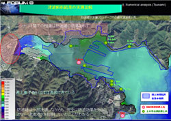
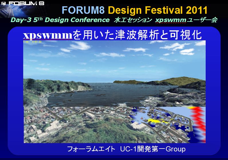
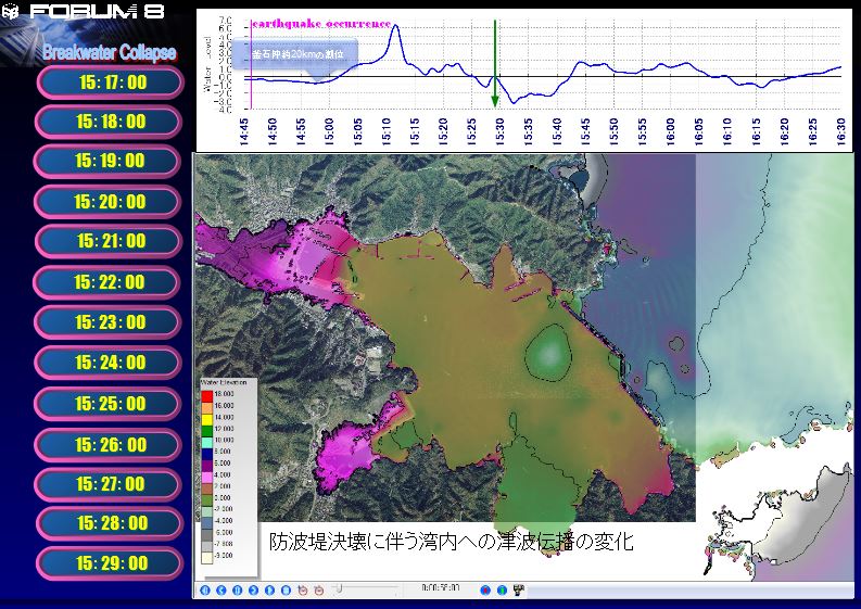
FORUM8 Design Festival 2011 The 5th Design Conference "Water Works" session Tsunami analysis and visualization by the xpswmm FORUM8 UC-1 Development Group 1
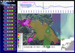
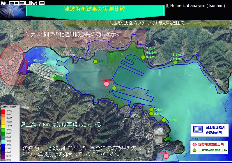
By mounting the scenario that the breakwater breaks on the way of the usual tsunami analysis, where the breakwater is fixed as the obstacle against the flow, the disaster damage at Kamaishi port is reproduced in the numerical simulation in order to show the probability of visualization towards disaster reduction.
Material PDF Material PDF (html) Hear Lecture 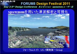
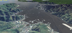

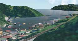

▲Linked with tsunami analysis software
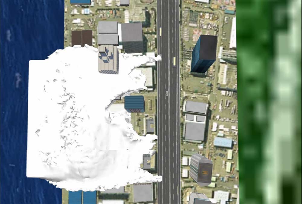
▲Reflection and inflection on water surface
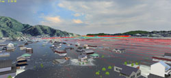
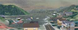
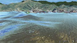
▲Tsunami caused around buildings
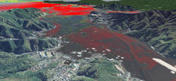
▲A few tens of seconds
after tsunami arrival (contour)
▲Vector expressing the flow velocity
of tsunami
The Mechanism of Tsunami Development
The ground underneath the seabed protrudes or subsides when an earthquake having a focus beneath the seabed occurs. This diastrophism makes the sea surface agitate vertically causing big waves which then turns into the propagating tsunami.
When the tsunami warning is announced, sailors undock their vessel and sail offshore as means of evacuation to avoid potential damages to their vessel. This is indeed a very rational maneuver because out in the ocean the tsunami behaves more or less like a big and deep tide that does not have the kind of wave energy capable of flipping over a ship, the kind predominant in places near the coast during the tsunami of the same scale.
The term “Tsunami” is a combination of two Japanese characters, both of which were derived from China: The character “Tsu” which means port, and “Nami” which means wave. The two characters combine to make one term which refers to a very destructive wave. The reason why these two characters were chosen is because this catastrophic wave does more damage to the ships docked at the port rather than these offshore. Presently the word “Tsunami” is used extensively throughout the world.
Tsunami velocity is the square root of the product of water depth and gravitational acceleration (v=√gd). If the water depth is assumed to be 4,000m, the tsunami velocity reaches approximately 720km/h(200m/s), which is the speed equivalent to that of a jet.
Example of Tsunami Analysis
●Overview
The Imamura Laboratory adopts the difference method of the shallow water equation for the numerical calculation of tsunami. The tsunami analysis involves a number of simulations including the river backflow simulation to predict the inundation area and inundation height if future tsunamis were to occur. These calculations are used to evaluate the wave power imposed on houses and buildings and predict flotsam/ jetsam/ driftwood/debris transport, and wave height as well as velocity at each mesh point to illustrate a wave height distribution over a map. The information on the seabed terrain comes from the materials publicly released by the Japan Coast Guard.
● Conditions that can be input
The information describing the focus of the earthquake (the magnitude, distance between the focus and the epicenter, location), the seabed terrain data (seabed elevation and location), and terrain are all available to be input as conditions.
● Example of Analysis Result
An example of the result of calculation done on the Earthquake Off Fukushima Prefecture on July 19, 2008 is introduced here.
The scale of the earthquake is quite big (M =6.6), and the focus is approximately 10km underneath the earth’s surface.
The research findings showed that the earthquake arrival time was 20 minutes behind the arrival time predicted by the Japan Meteorological Agency, however the former almost coincided with the observed arrival time, which proved the accuracy of the system.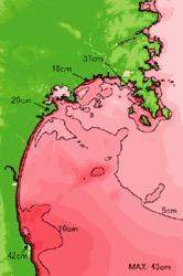
▲ Example of tsunami
height distribution
■ Tsunami Simulation (Proposed model that uses the smoothed-particle hydrodynamics analysis result) ■
Snapshots below show a VR model in which the smoothed-particle hydrodynamics analysis result is put to action as movable model that moves over time within UC-win/Road.
(The actual analysis result is not applied. Instead, the expression of tsunami is made possible using a VR model.)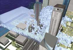

Tsunami Numerical Analysis Support Service
This is a complete set of analysis support service in which we take advantage of the practical tsunami analysis code developed in the Imamura Laboratory to create a hazard map or predict tsunami evacuation, or link the data with UC-win/Road for a highly accurate visualization.
As long as this tsunami analysis code is used, a very accurate and useful hazard map or a very good prediction of tsunami evacuation can be made.
Because the basic information such as terrain, buildings, and trees are interfaced with Road data and imported into UC-win/Road, manual input is not required saving a considerable amount of time. In addition, the analysis result of the tsunami analysis code are imported into UC-win/Road for visualization.
Conditions that can be input
The information describing the focus of the earthquake, the seabed terrain data, and terrain
Case Study on Tsunami Analysis
The result of calculation done on the Earthquake off Fukushima Prefecture on July 19, 2008. The predicted arrival time of the earthquake almost coincided with the observed arrival time.
Details of the research being conducted in the Tohoku University Imamura Laboratory
The Tohoku University Imamura Laboratory (lead by Professor Imamura) are doing the following kind of research on tsunami.
Research details:
A disaster is a consequence of an interference between the natural forces and human activities within the society. As human activities and behavior change over time, so does the situation surrounding each and every type of disaster. In order to take effective measure against future disasters we must not only base our potential measures on the aftermath of the past disasters but also predict the disaster propagation that undergo transformation with the development of society and to devise the kind of measure that has the potential to develop the region and at the same time protect it against vulnerabilities.
The Tsunami Engineering Laboratory is the only research institute in the world that conducts research on tsunami from the engineering standpoint. It is involved in the research based on field investigation in Japan and abroad and on measures against tsunami disaster for a particular region, as well as the development of tsunami’s numerical value prediction system that is highly accurate, based on the key principle of disaster measure and control. In particular, its tsunami analysis technique is so accurate that it is expected to be spread to many tsunami-prone countries. In fact, the technology transfer itself is one of the project that Tohoku University is engaged in, which is called TIME(Tsunami Inundation Modeling Exchange). Tsunami analysis codes developed by this research lab are already being used in more than7 countries for mitigation of the impact of tsunami disaster.
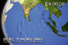
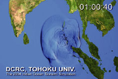
▲Analysis animation of Tsunami of the Indian Ocean (2004) (Tohoku University Tsunami Laboratory)
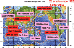
▲Location of tsunami of recent years
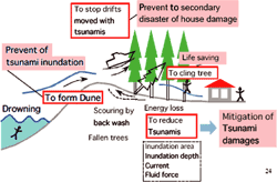
▲Several functions of coastal forest in Japan
(Hamada & Imamura,2003)


Price
Product Price
-
Click here for the price of UC-win/Road
■ Product Price
Product
Product Contents
Price
UC-win/Road Ultimate UC-win/Road
+
all pluginsUSD17,200 UC-win/Road Tsunami Plugin Option Plugin only USD3,360 ■ Price of Floating License
Paying 40% of the product price allows anyone to use the product on any PC anywhere in the world.
Product
Price
UC-win/Road Ultimate USD6,880 UC-win/Road Tsunami Plugin Option USD1,344
Price of Subscription Service Contract
Price of Subscription Service Contract
-
■Support information
-Software upgrade -Technical inquiry (Email, Tel)
-Download service -Maintenance and update notifications via email
* We are sequentially making a transition from the maintenance-support service to [Subscription Service] from April 1, 2016 in order to enhance support for diverse product usage and to reduce license management cost.
Product Subscription cost
of first yearSubscription cost
of subsequent years
(annual cost)Subscription (UC-win/Road Tsunami Plugin Option) Free USD1,344 Subscription (UC-win/Road Tsunami Plugin Option Floating) USD1,881
Price of Rental License / Floating License
■Rental license : Short term licenses available at a low price
■Rental floating license : After web activation, anyone can use the products on any PC anywhere in the world.
■Rental access : You can increase the number of licenses you own and use these additional licenses for a specific period of time (1 month to 3 month) at your discretion. We will later send you an invoice based on your usage log. The advance application is 15% off of the regular rental license price. Please place an order from User information page.
*Rental / Floating Licenses were introduced on September 2007 to enhance user experience and convenience of our products.
*Duration of Rental / Floating Licenses cannot be changed after starting these services. Re-application is required to extend the rental and floating license duration.
Rental license / Rental floating license
-
■Rental License
Product 2 month 3 month 6 month UC-win/Road Tsunami Plugin Option USD1,512 USD1,780 USD2,184 ■Rental Floating License
Product 2 month 3 month 6 month UC-win/Road Tsunami Plugin Option USD2,520 USD2,990 USD3,696 Order / Contact Us
Order / Contact Us
-
■Inquiries about UC-win/Road
If you have any question, please feel free to contact us via Sales inquiry or at ist@forum8.co.jp.
■Sales office


LOADING