|
| *xpswmm |
rainfall-runoff analysis system |
|
xpswmm is a complete software package for modeling Stormwater and Wastewater
flows and pollutants. It is used by scientists, engineers and resource
and asset managers to simulate natural rainfall-runoff processes and the
performance of engineered systems that manage our water resources.
xpswmm is used to develop link-node and spatially distributed models that
are used for the analysis, design and simulation of storm and wastewater
systems. xpswmm also models flow and pollutant transport in natural systems
including rivers, lakes, floodplains with groundwater interaction.
The following is key features and related system of this product.
*Key features
 hydrology: hydrology:
Hydrology Choices - choose from 14 hydrology methods including SWMM Runoff,
SCS Laurenson, SBUH, Rational method, Sacramento methods, LA County Hydrology,
and many others.
 hydraulics: hydraulics:
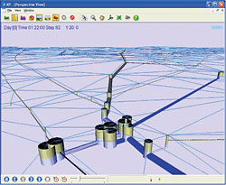
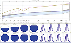
The xpswmm Hydraulics engine solves the complete St. Venant (Dynamic Flow)
equations for gradually varied, one dimensional, unsteady flow throughout
the drainage network. The calculation accurately models backwater effects,
flow reversal, surcharging, pressure flow and tidal outfalls and interconnected
ponds. The model allows for looped networks, multiple outfalls and accounts
for storage in conduits. Flow can also be routed using the US EPA EXTRAN
solutions and with kinematic or diffusive wave methods.
 wastewater: wastewater:
Quality routing is performed as plug flow or complete mixing in storage
units. Storage and treatment devices are simulated as a series and/or parallel
network of units each with optional flow-storage routing using the modified
Puls method. The treatment simulation uses either user-defined removal
equations (for example, removal as exponential function of hydraulic residence
time) or sedimentation theory coupled with particle size-specific gravity
distribution for constituents. The user may enter any valid equation to
describe the treatment of the various constituents and xpswmm will parse
this equation and apply it to the simulation
*Optional module
 xpFlood:2D (2D flood analysis): xpFlood:2D (2D flood analysis):
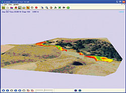
Whether you are modeling in 1 or 2 dimensions, integrating elevation data
is an essential step in constructing your model. xpswmm incorporates Digital
Terrain Models (DTMs) as Triangular Irregular Networks (TINs) into any
1D or 2D model.
 GIS module: GIS module:
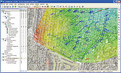
xpswmm is streamlined to utilize GIS and CAD data for modeling. It has
the ability to display raster and vector files as background images from
commercial drawing and GIS applications without the purchase of additional
software.With its integrated GIS link xpswmm enables you to exchange data
with other external databases such as ArcGIS, MapInfo, Asset Management
Software, Access and Excel or any other ODBC compliant database. xpswmm’s
layer control panel allows the management of geospatial data sets including
visualization and direct import of geometric objects such as polygons,
polylines and points to the appropriate xpswmm layer.
 xpswmm’s Real Time Control (RTC) optional module xpswmm’s Real Time Control (RTC) optional module
xpswmm’s Real Time Control (RTC) module expands the control capabilities
for gates valves, flow regulators, moveable weirs and, and telemetry-controlled
pumps. It extends RTC to a comprehensive management and design tool. It’s
sensors can be any combination of velocity, flow and water level at nodes,
conduits, pumps, weirs or orifices in the network
 XP-Viewer module: XP-Viewer module:
The XP Viewer allows data files to be opened and viewed but not modified.
The model may be freely distributed to anyone associated with your project.
Recipients will have the ability to view and generate all model output
including animations of your xpswmm models without the ability to change
the model(s) integrity or redoing the simulation. This is an excellent
tool for those customers who need to share their data with others who do
not own a license of the software, but wish to view the model(s) data and
results. |
|


 |
 Optimizing (PEST) module: Optimizing (PEST) module:
xpswmm uses a proprietary dynamic wave routing procedure. The solution
method is inherently stable and has a fast run time by using a self modifying
time step. Throughout the simulation, the time step is adjusted to insure
stability and flow balance. There are several techniques available to improve
the performance of the calculating engine. Additional simulation parameters
allow optimization of the solution.
*Developed by XP Software Pty Ltd (Canberra, Australia) URL:http://www.xpsoftware.com/
*Introduction of related systems: Visualization of result analysis on UC-win/Road
UC-win/Road is scheduled to visualize simulation results from xpswmm in
near future.
UC-1 series water and sewage/river (Japanese only)
- Box culvert design (earthquake-proof sewage system)
- Manhole design calculation
- Regulation pond/ Regaldating pond calculation
- Distribution basin earthquake resistant design calculation
- Flexible structure sluceway design
*iPipe sewer culvert integrated program
This program allows you the flexibility: you can calculate culvert, analize
pipe network, create calculation report, pipe network map and Longitudinal
and lateral profile. And it allows you to compare and weigh multiple plans
for one project.
Developed by Saman Corporation URL:http://www.samaneng.com/
|
(Up&Coming 2007 Midsummer issue) |
 |
|


>> 製品総合カタログ

>> プレミアム会員サービス
>> ファイナンシャルサポート
|


